An iconic Tour de France road to Col de Jau
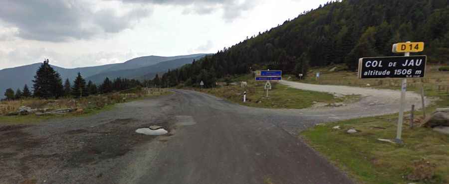
Col de Jau is a high mountain pass at an elevation of 1,509m (4,950ft) above sea level, located in the Occitania region of France.
Where is Col de Jau?
The pass is located on the boundary between the Aude and the Pyrénées-Orientales departments, in the southern part of the country. Near the pass are the ruins of the Cistercian abbey of Sainte-Marie de Jau.
Is the road to Col de Jau paved?
Set high in the eastern Pyrenees, the road through the pass is totally paved. On the northern side, the road is called D84, and D14 on its southern side.
How long is the road to Col de Jau?
The pass road is 27.1 km (16.83 miles) long, running from Mosset (in the Pyrénées-Orientales department) to Sainte Colombe sur Guette (in the Aude department).
How steep is the road to Col de Jau?
The road is pretty steep, hitting 9.8% through some of the ramps. Starting from Mosset, the ascent is 13.6 km long. Over this distance, the elevation gain is 806 meters. The average percentage is 5.9%. Starting from Sainte Colombe sur Guette, the ascent is 13.4 km long. Over this distance, the elevation gain is 896 meters. The average percentage is 6.7%.