How to get by car to Les Fonds in the Hautes-Alpes department?
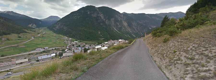
Les Fonds is a remote high mountain town located at an elevation of 2,040m (6,692ft) above sea level, located in the Hautes-Alpes department, within the Provence-Alpes-Côte d'Azur region of southeastern France. Tucked away east of the famous Col d’Izoard, this settlement is a hidden gem in the Cottian Alps.
| Road facts: Les Fonds | |
|---|---|
| Location | Hautes-Alpes, France |
| Length | 11.8 km (7.3 miles) |
| Elevation Gain | ~420 m (from Cervières) |
| Max Gradient | 7.5% |
| Road Name | D89T |
| Hazard Level | Moderate (Narrow road & high altitude) |
Is the road to Les Fonds paved?
The road leading to the town, known as the D89T, is fully paved. However, drivers should be prepared for a very narrow and challenging drive. The road lacks central markings and is barely wide enough for two vehicles to pass in many sections. It follows the natural curves of the Cervièrette torrent, offering a raw and immersive driving experience through a typical alpine glacial valley.
How long is the road to Les Fonds?
Starting from the village of Cervières, the drive to Les Fonds is 11.8 km (7.3 miles) long. While the distance might seem short, the narrow nature of the D89T means that progress is slow. The road is a "cul-de-sac," meaning it ends at the town, forcing drivers to return by the same route, which allows for a second chance to enjoy the massive peaks surrounding the valley.
What is the maximum gradient of the road to Les Fonds?
The ascent is steady but demanding, with several sections reaching a gradient of 7.5%. The road climbs from Cervières through a landscape of high-altitude pastures and larch forests. Given its elevation and location, the road is covered in snow during days in the winter months.