Is the C4 Route de Nice to Fortin du Restefond safe for driving?
Fortin du Restefond is a high-altitude military installation at an elevation of 2,558m (8,392ft) above sea level, located in the Alpes-de-Haute-Provence department of France. Situated within the Mercantour National Park, the site was a strategic barracks of the Maginot Line. Logistically, the approach is via the C4 Route de Nice, a high-mountain road that demands specific technical attention due to its age and military engineering origin.
| Road facts: Fortin du Restefond | |
|---|---|
| Location | Alpes-de-Haute-Provence, France |
| Elevation | 2,558 m (8,392 ft) |
| Length | 3.2 km (from Col de la Bonette) |
| Engineering Era | Early 20th Century (Military Logistics) |
How did military history shape the road to Fortin du Restefond?
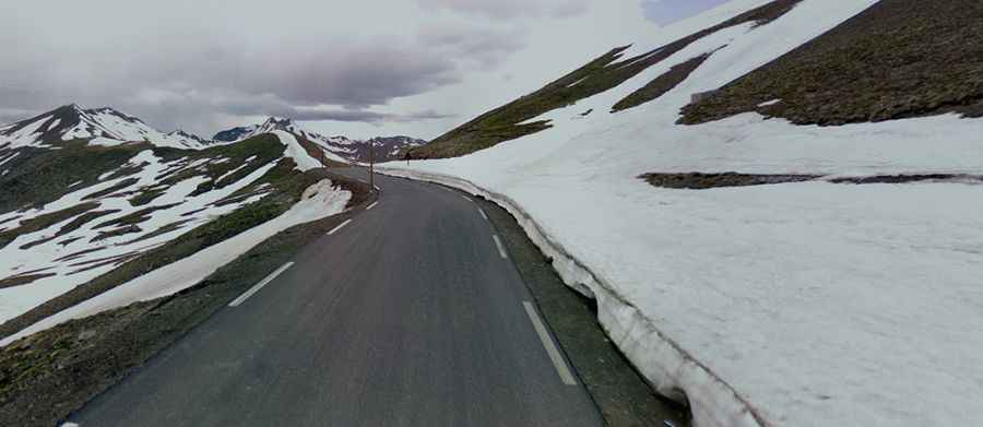
Technically, the C4 Route de Nice was engineered in 1860 and later upgraded in 1901 to support the heavy logistics of the casernement du Restefond. This military origin dictates the road’s current geometry: the gradients were designed to allow the transit of heavy artillery and supply convoys, reaching 10% in critical sectors. Logistically, the 3.2 km stretch from Col de la Bonette was built to withstand high loads, but the lack of modern maintenance means the 120-year-old roadbed is now severely fractured by frost action.
What are the mechanical risks of the Fortin du Restefond ascent?
Technically, driving at 2,558m reduces the efficiency of the vehicle's cooling system due to lower atmospheric pressure. Logistically, the C4 Route de Nice requires disciplined gear management. During the ascent, engines are under high load at low speeds, which can lead to rapid overheating. On the return descent toward the Bonette, engine braking is mandatory to prevent brake fade on the 10% ramps. The road lacks modern safety barriers, meaning any mechanical failure or loss of traction on the steep, unprotected shoulders presents a high logistical risk for vehicle recovery.
When is the road to Fortin du Restefond closed to traffic?
Due to its extreme elevation in the French Alps, the road to Fortin du Restefond is technically impassable for most of the year. Logistically, the route is closed from October to June, as it is buried under several meters of snow. Even during the summer months, the orographic lift in the Mercantour National Park can trigger sudden afternoon thunderstorms and freezing fog, drastically reducing traction on the aged asphalt. Safety protocols for this 3.2 km spur include checking tire tread depth and ensuring the battery is in peak condition, as cold starts at 2,500m are significantly more taxing on the vehicle’s electrical system.