Driving the 20 hairpins of Col de la Joux Verte: The road to Avoriaz
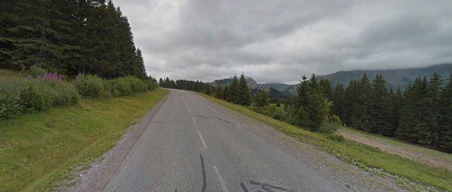
Located in the Haute-Savoie department, in the Auvergne-Rhône-Alpes region, Col de la Joux Verte is a high-altitude mountain pass that reaches 1,760m (5,774ft) above sea level. Situated close to the Swiss border, south of Lake Leman, this pass is traversed by the legendary D338 road, also known as the Route d'Avoriaz. It is a masterpiece of Alpine engineering where the vertical gain is managed through a relentless sequence of hairpins that demand absolute focus from any driver.
| Road facts: Col de la Joux Verte (D338) | |
|---|---|
| Location | Haute-Savoie, France (Alps) |
| Elevation | 1,760 m (5,774 ft) |
| Length | 11.2 km (from Morzine) |
| Hairpin Turns | 20 |
| Max Gradient | 12.1% |
How challenging is the D338 ascent to Col de la Joux Verte?
The climb starting from Morzine covers 11.2 km with a staggering vertical gain of 802 meters. While the average gradient sits at 7.16%, the Col de la Joux Verte features brutal ramps that hit 12.1%. The defining characteristic of the D338 is its 20 hairpin turns, which are tightly stacked one after another. For a vehicle, this means a continuous cycle of heavy acceleration out of the corners and hard braking before the next turn. If you are driving a manual transmission, the gear work is exhausting; if you are in an underpowered car, the thin air and steep inclines will quickly test your engine's torque and cooling system.
What are the hazards of the road to Avoriaz?
Beyond the steepness, the primary hazard on the way to the Avoriaz ski station is the sheer density of traffic. The road is a magnet for tourist buses, local logistics furgonetes, and thousands of cyclists, leaving very little room for error on the narrow asphalt. The hairpins are notoriously tight, often requiring you to swing wide into the oncoming lane to complete the turn—a dangerous maneuver on blind corners. During the winter and shoulder seasons, the asphalt can be treacherous due to black ice and runoff from the melting snow banks, which often carry gravel onto the driving line, reducing traction when you need it most.
What is the best driving strategy for the Haute-Savoie passes?
Navigating the 20 hairpins of the Col de la Joux Verte requires a rhythmic approach to the steering wheel and the pedals. It is essential to monitor your engine temperature gauges, as the low-speed, high-rev nature of the 11.2 km climb provides minimal airflow to the radiator. On the descent back to Morzine, do not rely on your foot brake; the sustained 7-12% gradients will cause your pads to smoke and fade within minutes. Use heavy engine braking and keep the vehicle in a low gear. In the French Alps, the vertical terrain always has the final word—respect the hairpins, watch for oncoming buses, and ensure your braking system is 100% before starting the drop.