How to drive the paved road to Col de Pinpinier?
Col de Pinpinier is a mountain pass at an elevation of 1.130m (3,707ft) above sea level, located in the Provence-Alpes-Côte d'Azur region of France.
Where is Col de Pinpinier?
The pass is located in the Alpes-Maritimes department, in the southeastern part of the country.
Is Col de Pinpinier paved?
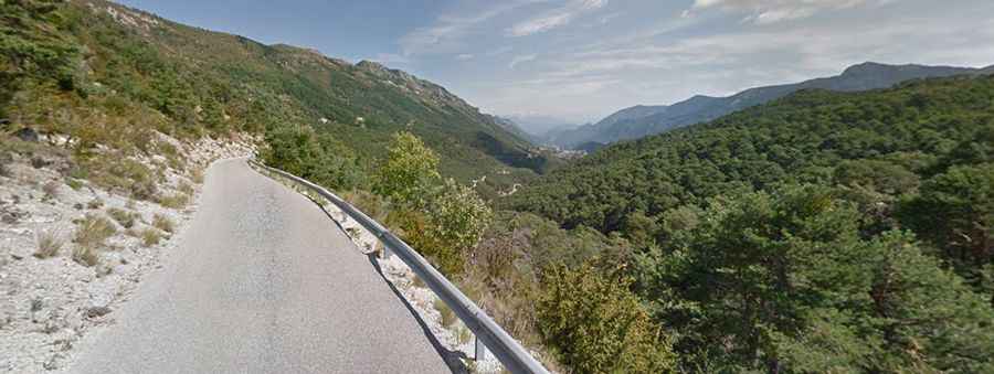
The road through the pass is fully paved, yet narrow (impassable for 2 average cars at the same time) and curvy (with 8 hairpin turns). It’s called D10. It provides great views of the area.
How long is the road through Col de Pinpinier?
The road through the pass is 8.0 km long, running west-east from the paved D5, near Col de Bleine to the village of Le Mas. Beyond this town, the road runs through the intense Clue d’Aiglun, probably one of the most iconic and challenging balcony roads of the country.