Col du Liorin: Driving the narrow paved climb in the Vercors Massif
Located in the heart of the Isère department in southeastern France, Col du Liorin is a mountain pass reaching an elevation of 1,226m (4,022ft) above sea level. This pass is situated within the rugged and limestone-dominated landscape of the Vercors Massif, a region famous among drivers for its high-altitude plateaus and dramatic balcony roads.
| Road facts: Col du Liorin | |
|---|---|
| Location | Isère, Auvergne-Rhône-Alpes, France |
| Elevation | 1,226 m (4,022 ft) |
| Length | 4.2 km (2.6 miles) |
| Road Surface | Paved / Narrow |
| Hazard Level | Moderate (Narrow lanes & Forest debris) |
Where is Col du Liorin?
The pass is located in the southeastern part of France, specifically in the Auvergne-Rhône-Alpes region. It sits strategically south of the famous Gorges de la Bourne, serving as a secondary mountain link within the regional park. The surrounding area is characterized by dense forests and open meadows, providing a quiet but technically demanding alternative to the more heavily trafficked tourist routes in the Isère area.
Is Col du Liorin paved?
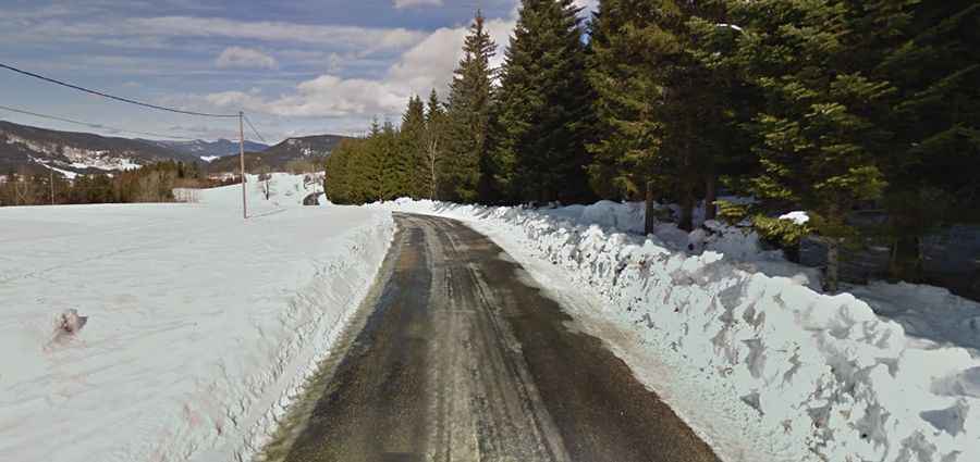
The road to the summit is fully paved, but drivers should not expect a standard wide highway. As seen in recent images, the surface is typical of a remote alpine lane: narrow, weathered, and often steep. The track is bordered by tall grass and pine forests, which can lead to slippery sections due to dampness or forest debris. There are no guardrails in many parts, requiring constant focus. Due to its width, passing an oncoming vehicle can be challenging, making it a route better suited for experienced drivers who enjoy technical "back-country" paved roads.
How long is the road through Col du Liorin?
The pass is 4.2 km (2.6 miles) long, running in a south-north direction from the village of Corrençon-en-Vercors to its junction with the D215C Road. Despite its short distance, the climb is intense, with significant vertical gain that tests the vehicle's torque. The road tightly hugs the hillside, offering glimpses of the higher Vercors ridges. Due to the elevation, winter conditions can make the pavement impassable without proper equipment, as snow and ice often linger in the shaded forest stretches well into spring.