A wild paved road to the top of Col du Negron
Col du Négron is a mountain pass at an elevation of 1,242m (4,074ft) above sea level, located in the Drôme department of France.
Where is Col du Négron?
The pass is located in the Auvergne-Rhône-Alpes region, in the southeastern part of the country.
How long is the road through Col du Négron?
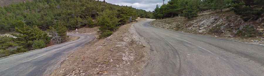
The road to the summit is fully paved. It’s called RD18. The pass is 14.7 km (9.13 miles) long running north-south from Col de la Pigiere to Revest-du-Bion.
Is the road through Col du Négron challenging?
The surface is in pretty bad condition and has steep parts. Starting from Revest-du-Bion, the ascent is 11.18 km long. Over this distance, the elevation gain is 319 meters. The average percentage is 2.85%. The maximum slope is 5%. The road features 5 hairpin turns and has a weight capacity of 15 tons signed. Risk of rock slides.