Col de la Sinne: A Balcony Road in the Alpes-Maritimes
Col de la Sinne (also known as Col de la Sinna) is a mountain pass at an elevation of 1,438m (4,717ft) above sea level, located in the Alpes-Maritimes department of France. At the summit (44.0255, 7.06854), there is a small historic chapel.
Where is Col de la Sinne?
The pass is located in the Provence-Alpes-Côte d’Azur region, southeastern France. While many maps focus only on the 8.5 km section between the D428 Road in Pierlas and Ilonse, the full scenic route spans 26 km (16 miles). It starts at the junction with the D28 (Gorge du Cians) and continues eastward to the M2205 junction. Driving the entire stretch takes approximately one hour due to the low speed required by the terrain.
| Road facts: Col de la Sinne | |
|---|---|
| Elevation | 1,438m (4,717ft) |
| Coordinates | 44.0255, 7.06854 |
| Distance | 26 km (Total route) |
| Max Gradient | 15% |
Is the road to Col de la Sinne paved?
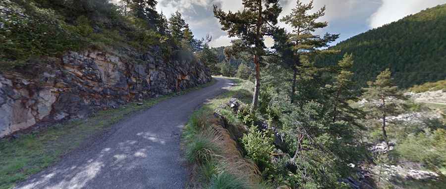
The road is fully paved but remains a classic narrow Alpine track. The surface is uneven in several sections with occasional potholes and debris. It is a typical French balcony road, offering significant vertical exposure (vertigo) and very few passing places.
Driving Challenges and Vehicle Restrictions
Narrow Sections: The road is extremely narrow. While it is technically manageable for motorcycles and standard cars, it is strictly unsuitable for motorhomes (mobilhomes).
Motorcycles: Contrary to some reports, the road is accessible for all types of motorcycles, including choppers, provided the rider has normal mountain driving experience.
Hairpins: The ascent from the western end (Pierlas) involves tight, steep hairpin bends that require precise maneuvering.
Reversing: Drivers must be confident in reversing on narrow ledges, as you may need to back up for a considerable distance to reach a passing point if you encounter oncoming traffic.
Summit and Views
The summit provides spectacular views of the surrounding mountains and is marked by a small chapel. The descent towards the east connects with the magnificent landscapes of the Gorge du Cians. Traffic is minimal, especially during midday hours.
Road suggested by: Mart Groen