How to drive the steep D160 road to Col du Merdassier?
Col du Merdassier is a mountain pass at an elevation of 1,500m (4,921ft) above sea level, located in the Haute-Savoie department, France. Situated in the Aravis Range, the pass serves as a logistical hub for the Manigod ski area. The final approach follows the D160 road, a mountain route characterized by its high-altitude exposure and technical drainage challenges during the snowmelt season.
| Road facts: Col du Merdassier | |
|---|---|
| Location | Haute-Savoie (Rhône-Alpes), France |
| Elevation | 1,500 m (4,921 ft) |
| Length | 2.4 km (from Col de la Croix Fry) |
| Road Number | D160 |
What are the driving conditions on the D160 to Col du Merdassier?
Starting from the junction at Col de la Croix Fry (D16), the ascent to the summit is 2.4 km long. Technically, the road is fully asphalted but narrow, with a roadbed that follows the natural contours of the alpine pastures. Logistically, the D160 is a dead-end for heavy transit beyond the resort, meaning drivers must account for high pedestrian and agricultural vehicle density during the summer months. The pavement is subject to frost heave, requiring constant attention to surface irregularities that can affect steering stability at higher speeds.
What are the visibility hazards at Col du Merdassier?
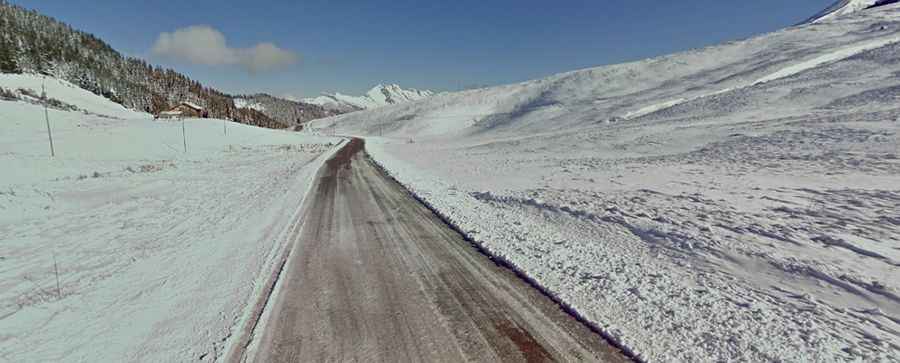
Technically, the pass is situated in a geographical pocket prone to heavy alpine mist and rapid orographic cloud formation. Logistically, these low visibility conditions turn the D160 into a high-risk corridor due to the lack of significant lighting and the proximity of steep embankments. Drivers must ensure that all vehicle lighting systems are functional before attempting the 2.4 km climb in overcast weather. During the winter, the road is a critical logistical link for the ski station, requiring winter tires or chains as the steep ramps often remain under a layer of packed snow despite regular plowing.
Is the road to Col du Merdassier open year-round?
Logistically, the Col du Merdassier is kept open throughout the winter to service the local tourism infrastructure. However, technically, the road can be temporarily closed during peak blizzard conditions or high avalanche risk. Safety protocols mandate a strict check on braking systems before the descent back to Col de la Croix Fry, as the sustained gradient, combined with potential ice patches in shaded sectors, can lead to loss of traction. The proximity of the Aravis massif also means that the road is subject to thermal inversions, where the asphalt temperature can be significantly lower than the ambient air, creating black ice hazards.