The road to Mont Vial is said to be the scary of scaries
Mont Vial is a high mountain peak at an elevation of 1.527m (5,009ft) above the sea level, located in the Alpes-Maritimes department in southeastern France. It’s one of the few peaks of the backcountry behind Nice that is recognisable from the sea.
The road to the summit is called Route du Mont Vial. It’s mostly one-lane. It’s paved but in bad conditions, with many hairpin bends and potholes. The road is steep, hitting a 13.6% of maximum gradient through some of the ramps. Starting at the N202 road, the ascent is 26.8km. Over this distance the elevation gain is 1.448m and the average percentage is 5.3%
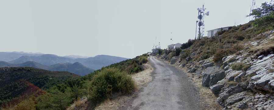
Drive with care as this is a mountain road with hairpin curves and dangerous drop offs. You might want to take this into consideration if you have passengers that don't like heights. Be prepared, this road is not for the faint of heart or ill prepared. One mistake can have serious consequences. At the summit there’s a communication tower, with great views of the sea, the Maritime Alps and the highest peaks of the Mercantour. Don't forget your camera with lots of film/memory, fully charged batteries and an empty memory card! Nice, Monaco and Cannes on the coast are all visible, and if you ascend the day after a Mistral, when the icy wind has scoured all the moisture out of the air, you may be blessed with Corsica’s dark profile on the horizon.
The road up to the peak (there is a radio station and a weather station) starts down in Saint Jean. It’s easy to find because there is a label with a hint. After passing by some private houses and before the “interesting” part of the road start there is a “driving forbidden” – label – which easily can be missed. The road is not in a good condition: there is gravel and dirt on the asphalt, sometimes grass is growing in the middle of the street and on the top there is no shadow. It can be extremely windy. From there you can see the church of “La Madone d'Utelle”.