Col de Ste-Anne: Driving the D28 through the Mercantour National Park
Located in the Alpes-Maritimes department of southeastern France, Col de Ste-Anne is a high mountain pass at an elevation of 1,551m (5,088ft) above sea level. Situated within the stunning Mercantour National Park, this pass serves as a vital alpine link in the Provence-Alpes-Côte d'Azur region, offering a drive through some of the most scenic high-altitude terrain in the French Alps.
| Road facts: Col de Ste-Anne | |
|---|---|
| Location | Alpes-Maritimes, France |
| Elevation | 1,551 m (5,088 ft) |
| Length | 6.4 km (4 miles) |
| Road Number | D28 / Route des Launes |
| Hazard Level | Moderate (Winter snow & Ice) |
Where is Col de Ste-Anne?
The pass is located in the heart of the Provence-Alpes-Côte d'Azur region, in the southeastern part of France. It is nestled within the protected area of the Mercantour National Park, a region famous for its deep canyons and high limestone peaks. Its geographic position makes it a strategic gateway for those traveling between the high-altitude ski resorts and the coastal valleys of the Mediterranean.
Is Col de Ste-Anne paved?
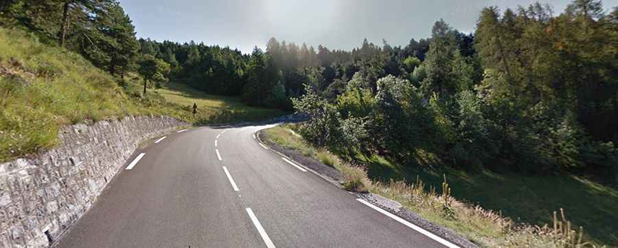
Yes, the road through the pass is fully paved. It is officially designated as the Route des Launes (D28). While the asphalt is generally in good condition, the road is characterized by its alpine nature: narrow in certain sections and winding through thick pine forests. As seen in recent winter images, the road is subject to early snowfall, and even if the pavement is clear, ice patches in shaded areas are a constant threat from late autumn until spring. Driving this route in winter requires full winter equipment (winter tires or chains) to ensure safety on the sharp curves.
How long is Col de Ste-Anne?
The pass is 6.4 km (4 miles) long, running in an east-west direction between the picturesque villages of Beuil and Valberg. Although the distance is short, the drive is intense due to the verticality of the landscape. The road climbs steadily, offering impressive views of the surrounding Mercantour peaks. Due to its proximity to the Valberg ski station, traffic can increase during the winter season and weekends. It is a scenic but technical drive that requires careful speed management, especially when navigating the descent towards Beuil, where the road tightly follows the mountain slopes.