Driving the D520B balcony road through Gorges du Guiers Mort
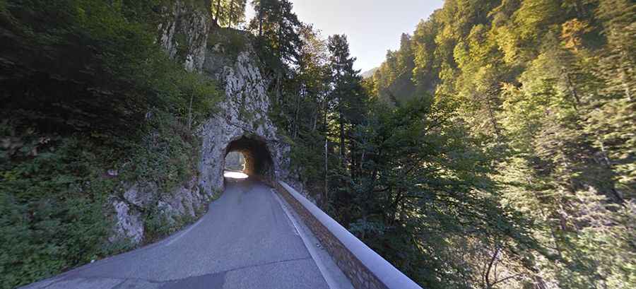
Gorges du Guiers Mort is a deep canyon located in the Isère department, in the Auvergne-Rhône-Alpes region of France. Traversed by the D520B road (known locally as the Route du Désert), the route is one of the notable balcony roads in France, carved directly into the limestone cliffs of the Chartreuse Regional Natural Park.
| Road facts: Gorges du Guiers Mort (D520B) | |
|---|---|
| Location | Isère, Auvergne-Rhône-Alpes (France) |
| Length | 9.9 km (6.15 miles) |
| Road Number | D520B (Route du Désert) |
| Height Limit | 3.8 meters (12.4 ft) |
| Surface | Paved balcony road |
Where is the D520B road through Gorges du Guiers Mort?
The road runs along the Guiers Mort river in the Chartreuse mountains. The 9.9-kilometer sector connects Saint-Laurent-du-Pont with La Diat, leading toward the Grande Chartreuse Monastery.
What are the driving conditions on the D520B?
The D520B is a paved but narrow balcony road carved into vertical rock walls. The route includes several unlit, narrow tunnels cut through the mountain face, with an uneven ceiling that enforces a strict 3.8-meter vehicle height limit. Due to the deep gorge topography, shade and river moisture keep the asphalt damp year-round, reducing tire grip along blind curves.
What hazards exist along Gorges du Guiers Mort?
Rockfalls from the overhanging limestone cliffs are frequent after heavy rain or freezing temperatures, leaving sharp stones on the pavement. Low stone curbs separate the single-lane roadbed from the river gorge below. Meeting oncoming delivery vans or buses requires stopping or reversing to wider passing pockets carved into the rock face.
Is the road through Gorges du Guiers Mort open year-round?
The D520B is kept open year-round, but winter frost creates persistent black ice inside the shaded canyon and tunnel entrances. Heavy snowstorms or major rockslides can cause temporary closures until road crews clear the narrow lanes.