How to get by car to the dangerous Altiport de Courchevel in the Alps?
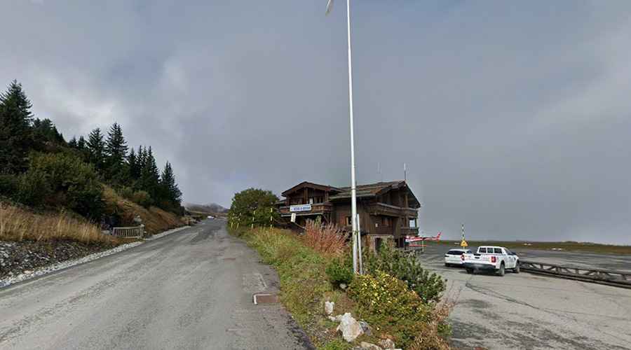
Located in the heart of the French Alps, Courchevel Airport is an altiport (a mountain airport) at an elevation of 2,014 m (6,607 ft) above sea level. It’s ranked as the seventh most dangerous airport in the world.
Where is Altiport de Courchevel?
The altiport is located in the commune of Saint-Bon-Tarentaise, in Savoie, Rhône-Alpes region, in the southeastern part of the country, within the Tarentaise Valley.
Why is Altiport de Courchevel used?
This altiport serves the popular ski resort of Courchevel, part of the Les Trois Vallées ski area. The airport is famous for being one of the most challenging and scenic airports in the world due to its short runway, steep gradient, and high-altitude location. The runway was featured in the opening of the 1995 James Bond movie GoldenEye.
How dangerous is Altiport de Courchevel?
Situated in a steep alpine valley and surrounded by mountains, Altiport de Courchevel is considered one of the world’s most dangerous airports. Its runway, which resembles a ski slope, is extremely short—measuring only 537 meters (1,762 feet)—and has an upward gradient of approximately 18.5–18.6%, helping aircraft slow down on landing but requiring precise technique for takeoff.
The surrounding terrain makes a go-around impossible once an aircraft is committed to landing, and there are no instrument approaches or runway lighting, meaning landings are visual-only and unsafe in poor visibility. Because of these challenges, pilots must have special certification or a permit to operate here.
The airport primarily serves smaller fixed-wing aircraft such as the Pilatus PC-12 and Cessna 208 Caravan, alongside a large volume of helicopter traffic, which accounts for about 70% of movements during the winter. Larger business jets are generally prohibited due to runway restrictions.
How long is the road to Altiport de Courchevel?
Set high in the French Alps, the road to the altiport is fully paved. It’s called Rue de l'Altiport. Starting from Le Praz, at 1,260 m above sea level, the ascent is 12.2 km (7.58 miles) long. Over this distance, the elevation gain is 754 meters, and the average gradient is 6.18%. The steepest section reaches 9.7%. The location has been used as a finish line for stages of the Tour de France professional cycling race.