How to get by car to Girotte Lake in Savoie?
Lac de la Girotte is a high mountain reservoir at an elevation of 1.753m (5,751ft) above sea level, located in the Savoie department of France.
Where is Girotte Lake?
The lake, with turquoise waters, is located in the Auvergne-Rhône-Alpes region, in the south-eastern part of the country.
When was Girotte Lake built?
Originally, it was a natural lake. The 30 million m³ of water was held back by a rocky barrier at the western end. The construction of a multi-arch dam, the first in the Beaufortain in 1942, doubled its capacity. Its waters, brought through 13 km of tunnels from the Tré la Tête Glacier, give it a quite milky appearance. The lake, with a depth of 134 m, is open for fishing. The site is not very secure, so it is not recommended for young children.
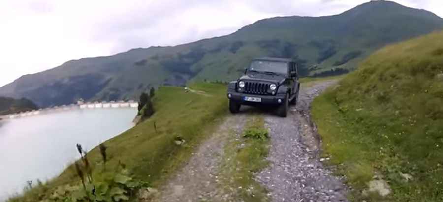
Is the road to Girotte Lake unpaved?
The road to the lake was built in the 1940s. It’s totally unpaved, narrow, and challenging. It’s closed to private vehicles and usually impassable in winter.
How long is the road to Girotte Lake?
The road is brutally steep, hitting 26.8% on some of the ramps. Starting at Parking de Belleville, the ascent is 5.5 km (3.41 miles) long. Over this distance, the elevation gain is 516 meters. The average gradient is 9.38%.
Is Girotte Lake worth it?
The drive is very scenic, with breathtaking views of the Hauteluce Valley. From the dam, there are beautiful views of the surrounding peaks and Mont Blanc.
Pic&video: REDBEARD OFFROAD