How to get by car to Lac de la Sassiere in the Tarentaise Valley?
Lac de la Sassière is a high mountain lake at an elevation of 2.462m (8,077ft) above sea level, located in the Savoie department of the Auvergne-Rhône-Alpes region, in France.
Where is Lac de la Sassiere?
The lake is situated in the French Alps, in the Tarentaise Valley, within the Parc national de la Vanoise in the Alps, in the southeastern part of the country.
Is the road to Lac de la Sassiere paved?
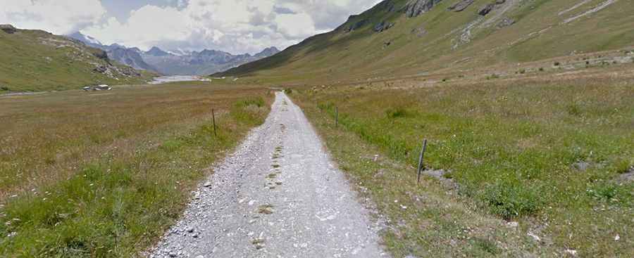
The road to the lake is pretty steep and narrow, known as Route de la Sassière. Only the first kilometers are paved. The asphalted part ends near a small dam, where there’s a parking lot for cars. The last 3.6 km are closed to cars but on a good quality unpaved road. Keep your eyes open: marmots and chamois are frequently visible on this road.
How long is the road to Lac de la Sassiere?
Starting from D902 Road, the road to the lake is 10.0 km (6.21 miles) long. Over this distance, the elevation gain is 648 meters, and the average gradient is 6.48%.