The road to Col des Tempetes, the windy ascent of Provence
Col des Tempêtes is a high mountain pass at an elevation of 1,829 meters (6,000 feet) above sea level, located in France. It is known for its windy conditions.
Where is Col des Tempêtes?
The pass is located in the Vaucluse department, in the Provence-Alpes-Côte d'Azur region, in the southeastern part of France.
Is Col des Tempêtes Paved?
The fully paved D974 road leads to the summit. This pass, unveiled in 1900, is just a kilometer away from Mont Ventoux, also known as "The Giant of Provence" or "The Bald Mountain." From the summit, a short road branches off to Tête de la Grave, another pass at 1,650 meters (5,413 feet) above sea level, spanning 3.9 km (2.42 miles) with asphalted and unpaved parts.
How challenging is Col des Tempêtes?
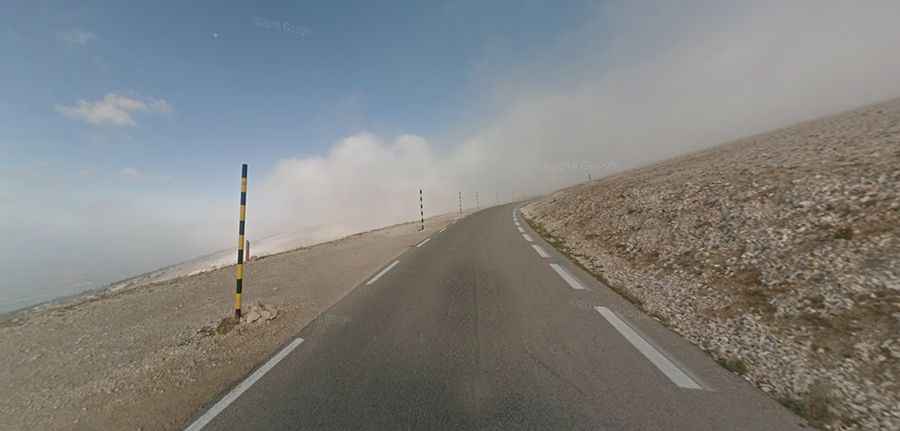
The road to Col des Tempêtes is challenging, with steep sections, no central markings, and a narrow path that barely allows two cars to pass simultaneously. The pass is known for its extreme wind speeds, with gusts reaching up to 320 km/h (200 mph) and regular winds over 90 km/h (56 mph) on 240 days a year. Due to these conditions, the road often faces closures.
Is Col des Tempêtes Open Year-Round?
The mountain's peak, devoid of vegetation, appears snow-capped typically from December to April. It is typically open from mid-April to mid-November but can be closed at any time due to bad weather.
Is Col des Tempêtes Worth the Drive?
Despite its challenges, the route offers unique views. The road twists through hairpin turns, rising to high elevations and descending steep grades. The summit provides great views of the Rhône valley.