An old military road to Col de La Buffere in the Alps
Col de Buffère is a high mountain pass at an elevation of 2.431m (7,975ft) above sea level, located in the Hautes-Alpes department, in France.
Where is Col de La Buffere?
The pass is located in the Provence-Alpes-Côte d'Azur region, in the southeastern part of France.
When was the road to Col de La Buffere built?
The road to the summit was constructed between 1902 and 1907 for military purposes. At the summit, remnants of military constructions from World War II can be found, part of the Ouvrage Col de Buffere of the Maginot Line. The ouvrage originally planned additional combat blocks, but these were either never completed or left unfinished.
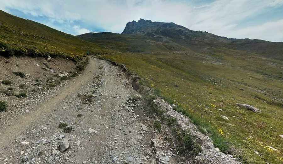
How challenging is the road to Col de La Buffere?
The road to Col de la Buffère, known as Piste du Col de La Buffere, is very scenic but challenging. It is entirely unpaved, with sections of gravel and rock. The ascent is steep, with some stretches having gradients as high as 20%. A 4x4 vehicle is recommended due to the rugged terrain and steepness of the road.
How long is the road to Col de La Buffere?
Starting from the paved D234T, this climb is 5.1 km (3.16 miles) long and gains 314 meters in elevation, averaging a gradient of 6.15%.
Is the road to Col de La Buffere open in winters?
Due to its altitude and Alpine conditions, the route is closed from late October to late June or early July.
Can I drive to Col de La Buffere?
While the beginning of the route is accessible, private vehicles are prohibited on the last portion leading to the summit. This restriction helps preserve the area and ensures visitor safety, given the narrow road and steep drop-offs.
Is Col de La Buffere worth visiting?
Located in the Écrins National Park, Col de la Buffère offers stunning views of the surrounding peaks. In addition to its natural beauty, the remains of military fortifications provide a glimpse into the region's historical significance.
Pic: Clément Poulain