Col de Bousson road: A high-altitude 4WD border crossing in the Cottian Alps
Col de Bousson is an international high mountain pass at an elevation of 2,154m (7,066ft) above sea level, situated directly on the border between France and Italy. This remote crossing in the Cottian Alps offers a technical unpaved driving experience through some of the most pristine landscapes in the Piedmont and Hautes-Alpes regions.
The drive is a classic alpine adventure, linking the Metropolitan City of Turin (Italy) with the French department of Hautes-Alpes. Known for its narrow tracks and steep gradients, the route to the summit is strictly for high-clearance 4x4 vehicles and experienced mountain drivers who are comfortable with rugged, unpaved terrain.
| Road facts: Col de Bousson | |
|---|---|
| Elevation | 2,154m (7,066ft) |
| Location | Bousson (Italy) to Hautes-Alpes (France) |
| Surface | Gravel / Unpaved |
| Vehicle Required | High-clearance 4WD |
| Hazard Level | Moderate/High (Narrow tracks, Steep climbs) |
How do you drive to Col de Bousson from the Italian side?
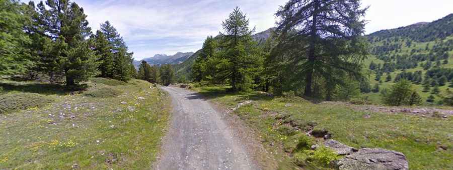
The journey typically starts in the Italian village of Bousson. From here, drivers must follow the signs directing them toward Lago Nero. The road quickly transitions from asphalt to a well-packed gravel surface as it climbs into the mountains. As seen in recent surveys of the Piedmont side, the track is narrow and winds through dense alpine forests, where the shoulder of the road drops off steeply into the valley.
What are the main hazards on the road to Col de Bousson?
Once you arrive near Lago Nero, you will encounter the small Capanna Mantino chapel. This is a crucial navigation point: after the chapel, you must turn right onto a significantly steeper uphill track. This specific section is narrow and demands good traction and throttle control. The surface is composed of loose dirt and small rocks, which can become incredibly slick after rain. The lack of guardrails means there is zero margin for error on the tighter bends.
Is the road to Col de Bousson open during the winter months?
Given its high elevation of over 2,100 meters in the Cottian Alps, the road is impassable for most of the year due to heavy snowfall. Typically, the route is only accessible from late June to September. Even in the summer, severe alpine storms can roll in quickly, turning the gravel tracks into slippery mud. Always check the local weather forecast before attempting the climb, as visibility can drop to a few meters in minutes.
Why is Col de Bousson a top 4WD destination?
Beyond the technical driving, Col de Bousson is famous for its "borderless" feel. One moment you are driving through the rugged Italian Piedmont, and the next, you are descending into the French Provence-Alpes-Côte d'Azur. The sense of isolation at the summit is profound, with 360-degree views of the jagged peaks that define the border between these two nations.