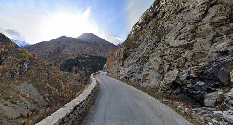
The iconic Route de la Berarde is a balcony road in France
Route de la Bérarde is a legendary drive located in the Auvergne-Rhône-Alpes region of France. Stay safe. This road is passable, but it can be impressive because it is winding and narrow. Crossings are difficult in some places. It's one of the French balcony roads.
Where is Route de la Berarde?
The road is located in the heart of the Isère department, in the southeastern part of the country.
When was Route de la Bérarde built?
Located right in the heart of the Écrins National Park, it was opened to vehicles in 1921. As soon as the road was finished, buses came into service, carrying not only passengers but also the orders for various shopkeepers (bread, meat, tinned goods, etc.).
Is Route de la Bérarde paved?
Route de la Bérarde (Road RD530) is totally paved. Be careful: this road is drivable but is impressive as narrow and winding.
How long is Route de la Bérarde?
Running along Le Vénéon river, the drive is 27.2 km (16.9 miles) long, from Le Clapier (at the junction with D1091 road) to La Bérarde (a town in the Réserve Naturelle de la Haute Vallée du Vénéon).
Is Route de la Bérarde dangerous?
The road, with steep drop-offs on one side, is very narrow in parts and features unlit tunnels, impassable for 2 cars at the same time. Locals call it the road to the end of the world, and it’s easy to see why. The road is steep and hits a 13% maximum gradient through some of the ramps. Running in the midst of a high mountain landscape, the road features steep drops, so those who are a little nervous of heights will want to take it easy along here. High risk of landslides.
How long does it take to drive Route de la Bérarde?
To drive the road without stopping will take most people between 40 and 60 minutes.
Is Route de la Bérarde open?
The road is usually open all year round, but is not recommended in winters. It can be closed anytime due to snow or ice.