How difficult is the D54 road to Col du Sappenay in France?
Col du Sappenay is a mountain pass reaching an elevation of 897m (2,942ft) above sea level in the Jura Mountains of eastern France. Located in the Savoie department, within the Auvergne-Rhône-Alpes region, the road over the pass—often spelled Col du Sapenay—is a technical and narrow asphalt track. Known as the D54 or Route du Sappenay, this climb is far more demanding than its modest elevation suggests, offering a series of tight hairpins and steep sections that overlook the northern tip of Lake Bourget.
| Road facts: Col du Sappenay | |
|---|---|
| Location | Savoie, Auvergne-Rhône-Alpes (France) |
| Elevation | 897 m (2,942 ft) |
| Length | 7.5 km (4.6 miles) from Chindrieux |
| Average Gradient | 7.38% |
| Hairpin Turns | 11 |
How long is the climb from Chindrieux to Col du Sappenay?
The ascent begins in the village of Chindrieux, near the shores of Lake Bourget, and covers 7.5 km (4.6 miles) to reach the summit. Over this short distance, the road gains 554 meters in elevation. The D54 is a typical secondary mountain road; it is fully asphalted but remains narrow and often lacks safety barriers. The climb starts intensely through the Néphaz Gorge, where the limestone walls and dense forest canopy create a claustrophobic driving environment. The road is constantly twisting, requiring low speeds and high concentration to navigate the uneven surface and the 11 sharp hairpin turns that define the mid-section of the route.
What are the driving hazards on the D54 Sappenay road?
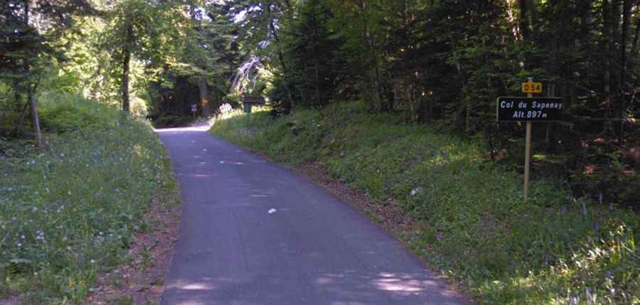
The primary hazard on the Route du Sappenay is the combination of the 7.38% average gradient and the narrowness of the asphalt. As seen in the forested sections, the road is barely wide enough for two cars to pass, and in many of the 11 hairpins, you must widen your approach to avoid hitting the inner curb, which is often broken or covered in debris. During autumn and winter, the road is frequently covered in wet leaves and moss, making the steep ramps and girs (turns) dangerously slippery. Visibility is often limited by the thick vegetation, and you must be alert for paragliders who use the take-off areas near the summit, as well as local agricultural traffic that may appear unexpectedly on the blind corners.
Is the descent from Col du Sappenay technical?
Descending toward the valley of Chindrieux requires careful brake management. The 7.5 km drop is relentless, and the 11 hairpins come in quick succession, leaving little time for the braking system to cool down. Utilizing engine braking is essential to prevent overheating the pads. The road surface is not always in top condition, and frost heaves in the asphalt can unsettle the vehicle during mid-corner braking. Additionally, the Néphaz Gorge section is prone to rockfalls after heavy rain, meaning you must be prepared for unexpected obstacles on the road surface as you exit the tighter turns.
Can you drive Col du Sappenay in winter?
While not a high-altitude Alpine pass, Col du Sappenay is located in the Jura Mountains, where winter weather can be severe. The D54 is not a primary transit road, so snow clearance is often delayed. At 897 meters, the temperature frequently drops below freezing, turning the humid forest road into a sheet of black ice. The 7.38% gradient makes traction a significant issue for front-wheel-drive vehicles without proper winter tires. If snow is present, the 11 hairpins become extremely hazardous, as the lack of guardrails in several sections provides no protection if a vehicle loses lateral grip and slides toward the embankment.