Is the road to Col du Clergeon in the Jura Mountains too steep?
Col du Clergeon is a mountain pass at an elevation of 979 meters (3,211 ft) above sea level, located in the Auvergne-Rhône-Alpes region of France. Situated on the boundary between the Savoie and Haute-Savoie departments, the route crosses the Jura Mountains along the D55 and D231 roads.
| Road facts: Col du Clergeon | |
|---|---|
| Location | Savoie / Haute-Savoie (France) |
| Elevation | 979 m (3,211 ft) |
| Length | 19.9 km (12.3 miles) |
| Elevation Gain | +796 m (2,611 ft) |
| Max Gradient | 10.5% (for 2 km) |
| Surface | Paved (Narrow and rough) |
How long is the road through Col du Clergeon?
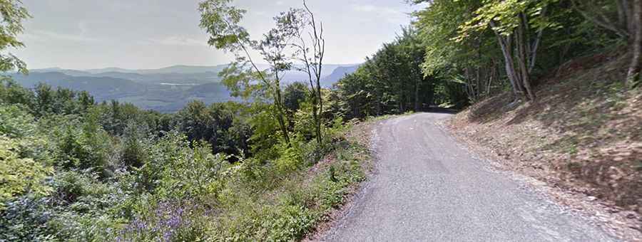
The drive across the pass is 19.9 kilometers (12.3 miles) long, running west to east from Ruffieux to Moye. The entire route is paved, though the asphalt surface is rough, narrow, and damaged by winter frost. The road climbs 796 meters in total elevation through dense forest, where the roadbed narrows down to a single lane without shoulders. Meeting oncoming traffic forces one vehicle to back up to a turnout spot.
How steep are the slopes on Col du Clergeon?
While the total climb averages 7.3%, the hardest section lies in the middle of the ascent. Two consecutive kilometers maintain a continuous 10.5% gradient, with short pitches exceeding that mark. Climbing these steep ramps requires staying in second or first gear to keep engine torque up, especially when carrying heavy loads or passengers.
What are the main hazards on the D55 and D231 roads?
The primary hazard on Col du Clergeon is the combination of blind forest corners and the narrow roadbed. In autumn, fallen wet leaves and mud from farm tractors make the 10.5% gradients slippery. On the steep descent toward Moye, continuous braking will quickly heat up brake pads, making engine braking necessary to keep speed under control.
Is Col du Clergeon open in winter?
The pass remains open for most of the winter, but heavy snowfall or black ice can temporarily block the road. As secondary departmental roads, the D55 and D231 are not plowed as frequently as major valley routes. During snowstorms, driving up the 10.5% slopes requires winter tires or snow chains to maintain traction.