How to drive the unpaved road to Le Taoulet in Occitania?
Le Taoulet is a high mountain peak at an elevation of 2.341m (7,680ft) above sea level, located in the Hautes-Pyrénées department of France.
Where is Le Taoulet?
The peak is located very close to the legendary Col du Tourmalet, in the Occitania region, in the south-western part of the country. At the summit there are nice views of Pic du Midi.
Is the road to Le Taoulet unpaved?
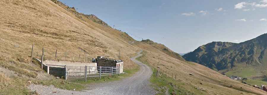
The road is entirely unpaved, with narrow parts, extremely steep sections and 9 challenging hairpin turns. It’s a service road for the chairlifts. 4x4 vehicles only.
How long is the road to Le Taoulet?
Starting from Col des Iris, the road to the summit is 1.4 km long. Over this distance, the elevation gain is 258 m and the average gradient is 18.42%.
Is the road to Le Taoulet open year-round?
Set high in the Pyrenees mountain range, the road is totally impassable in winters due to heavy snowfalls.