The breathtaking road to Col de Caron in the Massif de la Vanoise
Col de Caron is a high mountain pass at an elevation of 2.996m (9,829ft) above sea level, located in Orelle, a commune in the Savoie department of France. It's one of the highest roads of Europe.
Where is Col de Caron?
The pass is located in the Rhône-Alpes region in the south-eastern part of the country.
How long is the road to Col de Caron?
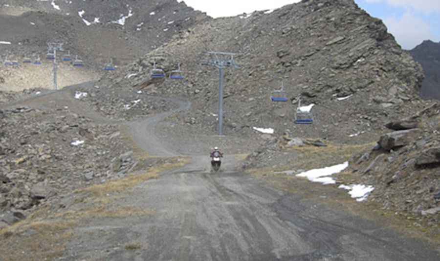
The road to the summit is entirely unpaved. It’s a ski-lift service road running north-south from Val Thorens ski resort to the village of Orelle. It’s called Val Thorens-Orelle road. The road is 28.3 km (17.58 miles) long and features 55 hairpin turns. The hairpins are signed and numbered. It’s a brutally tough drive with panoramic views of a thousand summits of France, Switzerland and Italy.
How to drive through Col de Caron in the Massif de la Vanoise?
4x4 vehicles only. The route roughly follows the line of the chairlift, passing under it now and then. The average gradient is 10.4 % but hits about 17-18% through some of the corners.
Is Col de Caron in the Massif de la Vanoise open?
Set high in the Massif de la Vanoise range, the road is usually drivable only in July and August. It's one of the highest roads of the country.
Road suggested by Pim van Dongen
Pic:http://wonderfulldays.nl/eurotrip/index.html