Col de la Traversette was Hannibal's route across the Alps
Col de la Traversette is a high mountain pass at an elevation of 2,369m (7,772ft) above sea level, located in the Savoie department in France. It’s said to be the place where Hannibal Barca and his army, along with elephants, entered Italy.
Where is Col de la Traversette?
The pass is located in the Auvergne-Rhône-Alpes region, in the southeastern part of the country, near the Italian border, to the south of Little St Bernard Pass.
Is the road to Col de la Traversette unpaved?
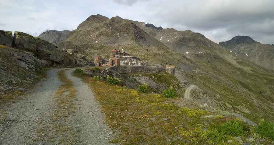
The road to the summit, also known as Colle delle Traversette, is totally unpaved. It’s an old military track for 4x4 vehicles or enduro only.
Why is Col de la Traversette famous?
The unpaved climb is very rideable, with stunning views and some history at the summit. It’s said that this is the pass where Hannibal led the Carthaginian army - which included 37 elephants - over the Alps into the Po Valley in Italy in 218 BC. The pass is located on the way to Le Fort de la Redoute, a high mountain fort built in 1630 by the House of Savoy and named 'Fort Traverset'. Access to the fort is actually prohibited due to the danger of collapse.
Is Col de la Traversette open in winters?
Set high in the Cottian Alps, a mountain range in the southwestern part of the Alps, the road is totally impassable in winters.
How long is the road to Col de la Traversette?
The road is really steep. Starting from the D1090 road, the ascent is 2.5km long. Over this distance, the elevation gain is 324m, and the average gradient is 12.96%, with sections up to 30%.
Pic: Radovan Podmanický