An epic paved road to Col de Restefond in the Alps
Col de Restefond is a high mountain pass at an elevation of 2.680m (8,790ft) above sea level, in the department of Alpes-de-Haute-Provence in France. It's one of the highest roads in the country.
Where is Col de Restefond?
The pass is located in the Provence-Alpes-Côte d'Azur region, in the southeastern part of the country, within the Mercantour National Park, next to Cime de la Bonette.
When was the road through Col de Restefond built?
The road through the summit runs from Nice to Briançon and was built in 1860, but the final route, by the summit of the Bonette, was built between 1960-1961. Close by are various ancient blockhouses, remnants of the Maginot Line's Alpine extension, the Alpine Line.
How long is Col de Restefond?
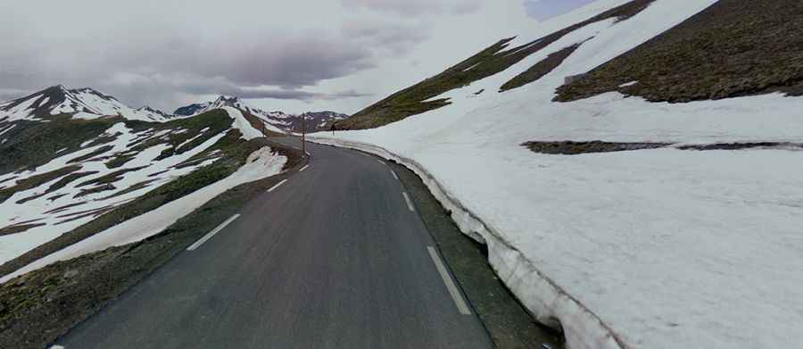
The road to the summit is fully paved. It’s called C4, also known as Route de Nice and Route du Col de Restefond. The pass is 47.2 km (29.32 miles) long, running from Jausiers (in the Alpes-de-Haute-Provence department) to Saint-Étienne-de-Tinée (a commune in the Alpes-Maritimes department).
Is Col de Restefond open in winter?
Set high in the French Alps, the road is closed due to ice and snow from November to May.
How steep is Col de Restefond?
Starting from Saint Etienne de Tinée, the ascent is 23 km long. Over this distance, the elevation gain is 1.512 meters. The average gradient is 6.6 %. Around Casernes de Restefond, an old military building, the gradient is around 8-9%.