Col de Bassachaux: The paved climb and the hidden gravel 4x4 descent
Nestled in the heart of the Portes du Soleil, in the Haute-Savoie department of France, Col de Bassachaux is a high mountain pass reaching an elevation of 1,778m (5,833ft) above sea level. This pass is a legendary balcony over the French Alps, sitting near the Swiss border and offering a dramatic contrast between a modern paved ascent and a rugged, high-risk gravel track on its southern flank.
| Road facts: Col de Bassachaux | |
|---|---|
| Location | Haute-Savoie, France (Alps) |
| Elevation | 1,778 m (5,833 ft) |
| Paved Route (D228A) | 10.4 km / 6.44% average gradient |
| Gravel Track | 4.4 km (South to Les Lindarets) |
| Hazard Level | Medium to High (on gravel section) |
Where is the road to Col de Bassachaux?
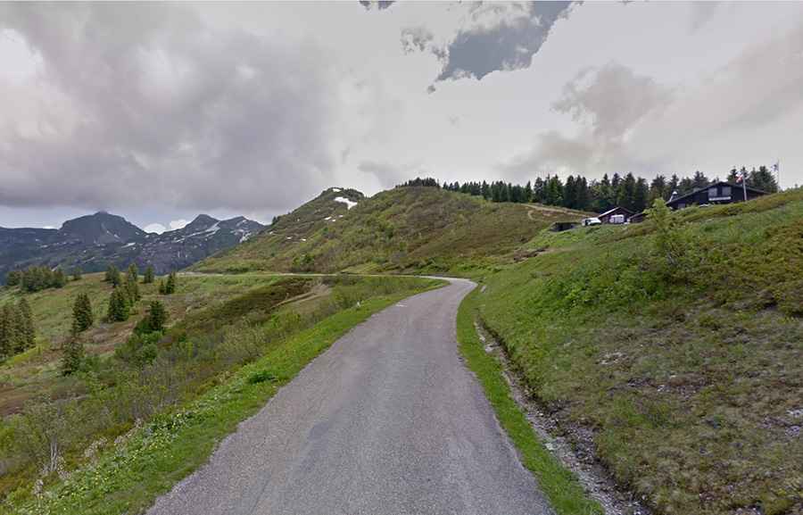
The pass is located in the Rhône-Alpes region, in the eastern part of France. The traditional access starts from the popular alpine village of Châtel. The road spans 10.4 km (6.46 miles), overcoming an elevation gain of 670 meters. This section, known as the D228A, is totally paved and ends in a parking lot at the summit, right next to the Refuge de L'Auberge de Haute Bise. The refuge is a key waypoint for travelers, typically open from mid-June to mid-September when the snow has cleared from the high pastures.
Is the road to Col de Bassachaux paved?
The northern approach from Châtel is paved but can be unnerving for inexperienced drivers. The D228A is a typical high mountain road, featuring narrow stretches and dangerous drops without substantial guardrails in several parts. While it is famous for the annual cycle race "La Montée de Bassachaux," drivers must stay alert for cyclists and livestock. However, the "real" challenge begins at the summit: the road to the south is a rugged gravel path that descends toward Les Lindarets, known locally as the "Village of Goats."
How to conquer the challenging gravel road to Bassachaux?
For those seeking an off-the-beaten-path adventure, the southern descent is the true test. This 4.4 km gravel road is extremely narrow and carved into steep gradients. It is a remote and rugged path that demands high confidence and skill behind the wheel. The edge of the road features unprotected drops, and the surface can be bumpy and loose, especially after a storm. This section is not suitable for beginners or low-clearance vehicles; it is a technical route that requires slow, obstacle-conscious driving. Extreme care is needed at every hairpin turn to manage the vertical exposure.
What are the hazards when driving the Col de Bassachaux?
The main hazard on the paved side is the combination of narrowness and summer traffic. However, on the southern gravel track, the risks multiply: erosion can create deep ruts, and sudden summer thunderstorms can turn the dirt into a slippery trap. Visibility can also drop rapidly due to alpine mist. Because the summit sits at nearly 1,800 meters, snow can linger late into the spring, making the unpaved section impassable. If you choose the "difficult way" down to Les Lindarets, ensure your brakes are in perfect condition and that you are prepared for a slow, technical crawl through one of the most beautiful but demanding landscapes in the Portes du Soleil.