The road to Col du Lachens isn’t an easy one
Col du Lachens is a high mountain peak at an elevation of 1.714m (5,623ft) above sea level, located in the Provence-Alpes-Côte d'Azur region of France.
Where is Col du Lachens?
The peak, also known as Mont du Lachens, is located on the boundary between the Var department and the Alpes-Maritimes department, in the extreme southeast corner of the country, within the Préalpes d'Azur Regional Natural Park.
Why is Col du Lachens famous?
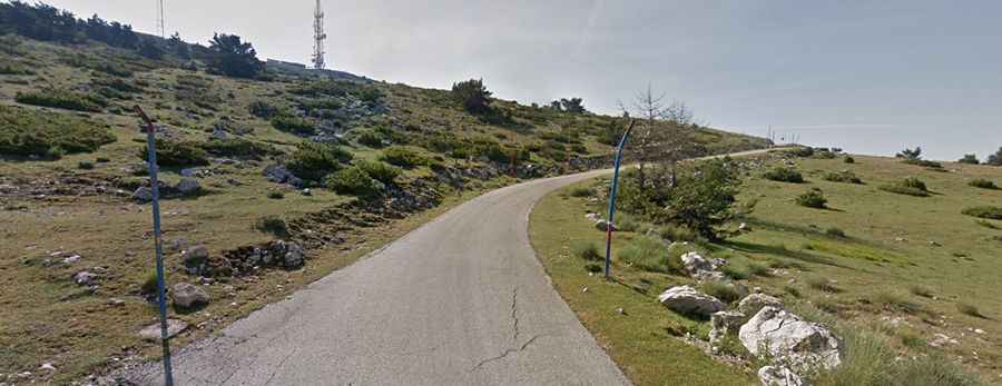
At the summit, there’s a military installation. In the past, Lachens was probably one of France’s most famous flying sites. It still hosts various paragliding competitions and is home of the National Free Flight Centre. Montagne de Lachens is the highest mountain in Var.
Is the road to Col du Lachens paved?
The road to the summit is totally paved. It's called Route Forestière du Lachens. It’s pretty narrow, and the surface is in really bad condition.
How long is Col du Lachens?
Set high in the Alpes-Maritimes, the road to the summit is 11.4 km (7.08 miles) long starting from Col de Clavel on the D21 road. Over this distance, the elevation gain is 750 m and the average gradient is 6.57%.