A Delightful Yet Challenging Paved Road to Col du Soulor in the Pyrenees
Col du Soulor is a high mountain pass at an elevation of 1,474m (4,835ft) above sea level, located in the Hautes-Pyrénées department in France.
Where is Col du Soulor?
The pass is located in the Occitania region, in the southwestern part of the country.
Is the road through Col du Soulor paved?
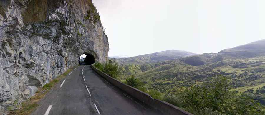
Set high in the Pyrenees, a range of mountains in southwest Europe that forms a natural border between France and Spain, the road through the pass is totally paved. It’s called D918 Road. The road, part of the iconic Route des Cols des Pyrénées, is narrow in parts and features some tunnels. It’s one of the most scenic Balcony Roads in the country.
How long is Col du Soulor?
The road is about 45km (28 miles) long, running east-west from Argelès Gazost to Eaux-Bonnes.
How steep is Col du Soulor?
The pass has been climbed by the Tour de France bicycle race, normally in conjunction with the Col d'Aubisque. It has very steep parts, hitting an 11% through some of the ramps. Starting from Argelès Gazost, the ascent is 19.48 km long. Over this distance, the elevation gain is 1,019 meters. The average percentage is 5.2%. And starting from Eaux-Bonnes, the ascent is 22 km long. Over this distance, the elevation gain is 1,074 meters. The average percentage is 4.9%.