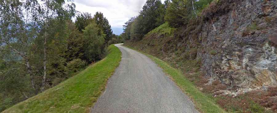
A demanding narrow ridge road to Col de Portel in the French Pyrenees
Col de Portel is a mountain pass at an elevation of 1,432m (4,698ft) above sea level, located in the Ariège department of France. This narrow strip of asphalt traces the high spine of the Massif de l'Arize, offering a spectacular journey across several Pyrenean summits.
Where is Col de Portel?
The pass is situated in the Occitania region, in the southwestern part of the country. It is the highest point of the D72, a remote mountain road that connects Saint-Girons and Foix by following the mountain crests.
🏔️ Massif de l'Arize Ridge Data
| Elevation Portel | 1,432m (4,698ft) |
| Ridge Length | 7.1 km |
| Max Gradient | 15% (Crouzette climb) |
| Road Character | Narrow Ridge Road (D72) |
One Ridge, Three Passes: Portel, Crouzette, and Pradel
The D72 is a unique route because it stays at high altitude for several kilometers, crossing three distinct passes in quick succession. To avoid "thin content" and provide a complete guide, these three milestones are best explored together:
- Col de Portel (1,432m): The highest and most prominent summit of the ridge.
- Col de la Crouzette (1,241m): Located at the western end, famous for its brutal 15% ramps on the ascent from Biert.
- Col de Pradel (1,287m): A secondary pass located on the same D72 line, offering panoramic views of the valley floor.
Is Col de Portel paved?
The road to the summit is fully paved but notoriously narrow and unprotected. It follows the natural contours of the ridge with virtually no guardrails.
- Tour de France: Due to its steepness and technical nature, this section has been featured in the Tour de France (notably via the connection to Mur de Péguère).
- Road Conditions: The asphalt is often bumpy and aged. Given the narrowness, passing another vehicle requires extreme caution and utilizing the rare wider spots along the crest.
How long is Col de Portel?
The most intense section of the ridge road is 7.1km (4.41 miles) long, running east-west from the famous Mur de Péguère to Col de la Crouzette. This segment remains consistently above the tree line in many parts, offering 360-degree views of the Pyrenees.