Lac de Cap-de-Long: One of the Highest Paved Roads in the French Pyrenees
Lac de Cap-de-Long is a high mountain lake located at an elevation of 2,161m (7,089ft) above sea level in the Hautes-Pyrénées department of France. It’s one of the highest paved roads in the French Pyrenees, even higher than the famous Col du Tourmalet.
Where is Lac de Cap-de-Long?
The lake is situated south of Lac d'Aubert, in the Occitania region of southwestern France. It curves around the northernmost part of the Crête des Alharisses, offering breathtaking views of the surrounding mountains.
Is the Road to Lac de Cap-de-Long Paved?
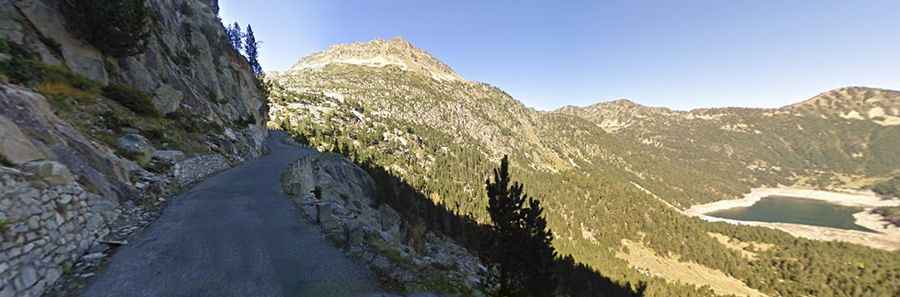
Yes, the road to the largest reservoir in the Pyrenees is fully paved, although narrow in some sections. Known as D929 (or Route des Lacs), the road is a cul-de-sac climb that leads to the stunning high-altitude lake. As the road winds toward the dam, the final stretch includes a series of hairpin turns, adding to the adventure of the drive.
How Long is the Road to Lac de Cap-de-Long?
Starting from Aragnouet, the ascent is 13.5 km (8.38 miles) long, with an elevation gain of 1,029 meters. The average gradient is 7.62%, with some sections reaching a challenging 11.8%. At the end of the road, there’s a large parking lot, and the area can be quite busy during the high season. There’s also a café and access to numerous scenic hiking trails for visitors to enjoy.