An iconic road to Col du Grand Colombier in the western Alps
Col du Grand Colombier is a high mountain pass at an elevation of 1.501m (4,925ft) above sea level, located in the department of Ain in France.
Where is Col du Grand Colombier?
The pass is located in the Auvergne-Rhône-Alpes region, in the eastern part of the country.
How long is Col du Grand Colombier?
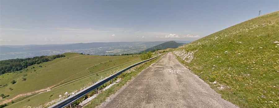
Tucked away in the Jura mountains, north of the western Alps, the road to the summit is fully paved. It’s called D120. The pass is 30 km (19 miles) long, running north-south from the D69 road to Culoz. The road is near deserted.
How steep is Col du Grand Colombier?
The pass has seen frequent use in cycling. It was visited by the Tour de France for the first time on Stage 10 of the 2012 tour. The road is very steep, hitting a grueling 19% of maximum gradient through some of the ramps, and features countless hairpin turns. The most demanding part of the climb is known as Lacets du Grand Colombier.
Is Col du Grand Colombier worth the drive?
At the summit is a big parking lot with stunning views. The view from the summit is superb, either down the valley of the Rhône, the Lac du Bourget and the gorges of Val-de-Fier, or the distant peaks of the Alps.