Col du Glandon is one of the toughest climbs in the French Alps
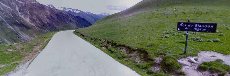
Col du Glandon is a high mountain pass at an elevation of 1.930m (6,332ft) above sea level, located in the Savoie department of France. It’s one of the toughest climbs in the French Alps.
Where is Col du Glandon?
The pass is located in the Auvergne-Rhône-Alpes region, in the south-eastern part of the country. At the summit there’s a big parking lot and a bar-restaurant is located nearby.
How long is Col du Glandon?
The road is totally paved. It’s called D927. The pass is 46.4 km (28.83 miles) long, running from Barrage du Verney to La Chambre. This is the first climb and descent that is used in La Marmotte sportive every July.
Is Col du Glandon open in winter?
Set high in the Dauphiné Alps, the road through the summit is usually closed from the beginning of November to mid May. The road to the top is a varied climb with a range of slopes, with great views at the summit. It was built in 1898 and was first used in the Tour de France in 1947. Since then it has been used many times. It gets a decent amount of traffic in summer.
How steep is Col du Glandon?
The road to the summit is steep, hitting a maximum gradient of 15.5% through some of the ramps. The col de Glandon is a straightforward col with a gradient that increases near the summit with the last seven kilometres being the toughest on the whole climb. The last two kilometres are over ten percent with stretches of 12 percent. Starting from Barrage du Verney, the ascent is 24.12 km long. Over this distance, the elevation gain is 1.152 meters. The average percentage is 4.8 %. And starting from La Chambre, the ascent is 21.3 km long. Over this distance, the elevation gain is 1.472 meters. The average percentage is 6.9 %.