An epic road to Port de Bales in the French Pyrenees
Port de Balès is a high mountain pass at an elevation of 1.760m (5,774ft) above sea level, located in the Occitanie region of France.
Where is Port de Bales?
The pass is located on the boundary between the Hautes-Pyrénées and the Haute-Garonne departments, in the southwestern part of the country, near the Spanish border.
Is the road to Port de Balès paved?
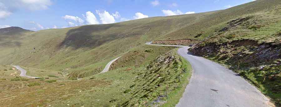
The narrow road to the summit, also known as Col de Balès, is totally paved. It’s called D925 and D51D. The drive is pretty defiant, with dangerous drop offs and without guardrails. There is little traffic on the road. No facilities at the summit. The road to the summit was a mule track until 1980, when the road was paved for first time. The snow and the lack of maintenance deteriorated severely the surface and remained virtually impassable until it was resurfaced during the summer of 2006 by the organizers of the Tour de France, that were looking for new routes in the Pyrenées.
Is Port de Balès open?
Set high in the central Pyrenees, the pass is generally closed by snow for long periods during the winter.
Is Port de Balès steep?
The road is pretty steep, hitting a 13.3% of maximum gradient through some of the ramps. It has been climbed by the Tour of France and the Vuelta a España races.
How long is Port de Balès?
The pass is 25.3 km (15.72 miles) long, running south-north from Bourg-d'Oueil (in the Haute-Garonne department) to Mauléon-Barousse (in the Hautes-Pyrénées department).
Is Port de Balès worth the drive?
It’s a broad open summit with excellent views of the snow capped Spanish frontier mountains. A magnificent 360 degree panorama of the surrounding mountains awaits you.