An epic road to Col d'Azet in the Pyrenees
Col d'Azet is a high mountain pass at an elevation of 1,580m (5,183ft) above sea level, located in the Hautes-Pyrénées department of France.
Where is Col d'Azet?
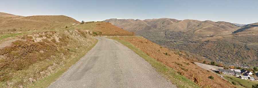
The pass, also known as Col de Val Louron Azet, is located in the Occitania region, in the south-western part of the country. There is a little parking at the summit with no facilities. Hang-gliders frequent the skies.
Is Col d'Azet paved?
The road to the summit is fully paved, yet not in the best condition. It’s narrow in parts and lacks guardrails.
How long is Col d'Azet?
The road is 18.2 km (11.30 miles) long, running west-east from Saint-Lary-Soulan to Génos.
How steep is Col d'Azet?
Tucked away in the Pyrenees, it’s a scenic climb and provides excellent views from the summit. It has been featured in the Tour of France bicycle race. Both sides are rather steep in the lower kilometres and ease a little nearer the summit. However, the average gradient is up to 8% on both sides. It has very steep sections through the village of Azet.