The legendary Col d'Aubisque is an iconic Tour de France climb
Col d'Aubisque is a high mountain pass at an elevation of 1.713m (5,620ft) above sea level, located in the Aquitaine region of France. It’s one of the most iconic climbs in the country.
Where is Col d'Aubisque?
The pass is located on the boundary between Pyrénées-Atlantiques and Hautes-Pyrénées departments, in the southwestern part of the country.
When was the road to Col d'Aubisque built?
The road to the summit was cut into the mountain in the early 1900s. There is a café at the summit which is open year-round. It is a popular lunch destination with cyclists with sweeping views of both the Pyrenees-Atlantiques and Hautes-Pyrenees.
Why is Col d'Aubisque famous?
The iconic pass is one of the most famous mountain climbs on the Tour de France and has been crossed by the race many times. The first time was in 1910. Together with the Col du Tourmalet and the Col du Galibier, it is one of the "big three" in the French race. The Vuelta a España has also included the climb. At the top, you will find several monuments that illustrate the cycling history that has been made on the mountain. The drive offers sweeping panoramas steeped in legend and provides lots of driving pleasure.
How long is Col d'Aubisque?
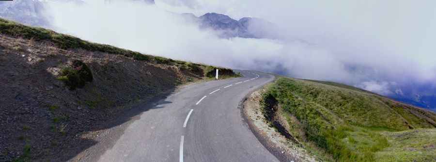
The road to the summit is totally paved, heading deep into the high mountains. It’s the spectacular D918, a balcony road. The pass is 45km (27.96 miles) long, running west-east from Laruns (in the Pyrénées-Atlantiques department) to Argelès-Gazost (in the Hautes-Pyrénées department).
How hard is Col d'Aubisque?
Tucked away between the valleys of the Gave d'Ossau and the Gave de Pau, the road to the summit is very steep, hitting a 14.8% maximum gradient through some of the ramps. The road crosses the extremely narrow Cirque du Litor, in the upper part of the Ouzom valley.
Is Col d'Aubisque open?
Set high in the Pyrenees mountain range, on the northern slopes of the Pic de Ger, the road is generally closed from December to June but can be closed at any time when the access is not cleared of snow.