How to get by car to Refuge de Laval in the Hautes-Alpes?
Refuge de Laval is a high mountain refuge at an elevation of 2,008m (6,587ft) above sea level, located in the Hautes-Alpes department of France.
Where is Refuge de Laval?
The shelter is located in the Provence-Alpes-Côte d'Azur region, in the southeastern part of the country, within the Vallée de la Clarée.
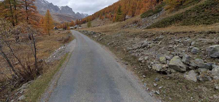
Is the road to Refuge de Laval unpaved?
The lonely road to the shelter is totally paved but narrow and a bit rough. It’s called D301T. The last 200 m of the road are on a very rough unpaved road.
How long is the road to Refuge de Laval?
Starting from Névache, the road to the refuge is 9.3 km (5.77 miles) long.
When can I drive to Refuge de Laval?
The shelter is closed in winters. In summer, before 8 a.m., you can drive by car via the road to the Laval parking lot (paid); the refuge is located 200 meters below the road, nestled against the rock. Otherwise, after 9 a.m., take a shuttle to the Laval parking lot, which is the end of the road.