How to get to Refuge du Plan du Lac in the Alps?
Reaching the Refuge du Plan du Lac is a journey into the high-altitude silence of the Vanoise National Park. At 2,370m (7,775ft) above sea level, this mountain hut in the Savoie department of France sits surrounded by glaciers and 3,000-meter peaks. The road from the valley is spectacular, but it’s not a free-for-all; this is protected territory, and the rules for driving here are as strict as the winter weather.
| Road facts: Refuge du Plan du Lac | |
|---|---|
| Location | Savoie, Vanoise National Park (France) |
| Elevation | 2,370m (7,775ft) |
| Access | Restricted beyond Bellecombe (Parking required) |
| Surface | Paved / Narrow / Steep Hairpins |
Where is the road to the refuge?
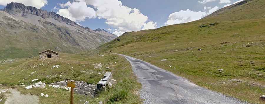
The drive starts in the Maurienne valley, specifically from Val-Cenis (Termignon). The 15.1 km (9.38 miles) climb is a classic Alpine ascent. The first few kilometers hit you with tight hairpins through the forest, quickly gaining elevation and leaving the valley floor behind. As the trees thin out, the landscape opens up into a massive high-altitude plateau. The road is paved but narrow, and during the summer months, you'll be sharing it with plenty of cyclists and the local "navettes" (shuttle buses).
Can I drive my car to the Refuge du Plan du Lac?
Here is the catch: you cannot drive all the way to the refuge doors. Private vehicle access ends at the Parking de Bellecombe. Beyond this point, the road is strictly reserved for authorized vehicles, park rangers, and people with specific disabilities (who must request a permit from the Vanoise National Park authorities). For everyone else, the last stretch is a 15-minute walk or a quick ride on the electric shuttle. This restriction keeps the area quiet and protects the local wildlife, especially the marmots that are everywhere in this sector.
Is the road to Refuge du Plan du Lac worth the drive?
The drive is worth it just for the panorama at the top. From the refuge area, you are staring directly at the Grande Casse (the highest peak in Savoie at 3,855m) and the massive glaciers of the Vanoise. If you keep going on foot or bike beyond the refuge, the small paved track leads to the tiny Chapelle Saint-Barthélemy (2,284m). It’s a desolate, beautiful spot where the peaks of Pointe de la Réchasse and Dent Parachée dominate the skyline. In the winter, the entire road is buried under meters of snow, and the refuge operates only as an unmanned winter shelter.
How difficult is the drive to Refuge du Plan du Lac?
Because the road is narrow and steep, the descent back to Termignon is a real test for your brakes. Don't ride them all the way down; use your engine to help slow you down. Also, keep an eye out for the shuttle buses coming up—they have priority, and on some of the tightest bends, there isn't enough room for two vehicles. Pull over into the "crossing points" early if you see a bus approaching. The road is bumpy in sections, but any standard car can make it to the Bellecombe parking lot without issues as long as the snow has cleared, usually from June to October.
Getting to Plan du Lac is about leaving the noise of the valley behind. Respect the parking rules, watch for cyclists on the hairpins, and take your time to enjoy the views of the glaciers. The Alps are unforgiving if you rush, but they reward those who focus on the road and the environment. Check the weather before you leave Val-Cenis and make sure your camera is ready. It’s a high-altitude journey you won’t forget.