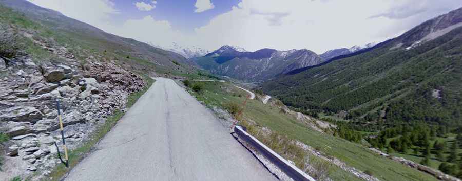
A steep paved road to Col de Vars in the Alps
Col de Vars is a high mountain pass at an elevation of 2.108m (6,916ft) above sea level, located in the Provence-Alpes-Côte d'Azur region of France. The pass is traversed by the scenic Route des Grandes Alpes.
Where is Col de Vars?
The pass is situated on the boundary between the departments of Hautes-Alpes and Alpes-de-Haute-Provence in the southeastern part of the country. It connects the Ubaye Valley with the Queyras valley and Embrun. It’s located is in the center of a series of high paved passes: typically, this pass precedes or follows the climb of the Izoard in most itineraries.
How long is Col de Vars?
The winding road to the summit is fully paved. It’s called D902. The pass is 13.0 km (8.07 miles) long, running north-south from Vars (in the Hautes-Alpes department) to Saint-Paul-sur-Ubaye (in the Alpes-de-Haute-Provence department). The road to the summit is steep, hitting a maximum gradient of 12% through some of the ramps.
Is Col de Vars worth it?
The road offers stunning views of small French towns and mountains. At the summit, you'll find a small bar and a parking lot. The pass has been a part of the Tour de France race multiple times and is considered one of the great cols of the Alps. The road is pretty busy in summer months due to being part of the Grandes Route des Alpes and one of the few roads crossing this section of the Alps.
When was the road to Col de Vars built?
The road through the pass was constructed by the army in 1893, initiated by General Berge, commander of the 14th corps of Lyon.
Is Col de Vars open?
Located high in the Alps, the pass is accessible year-round, except during periods of heavy snowfall in winter.