A Paved Road to Col de Port in the French Pyrenees
Col de Port is a mountain pass at an elevation of 1,249m (4,098ft) above sea level, located in the Ariège department, in France.
Where is Col de Port?
The pass is located in the Occitania region, in the southwestern part of the country, and links the Couserans and Ariège valleys.
Is the road through Col de Port paved?
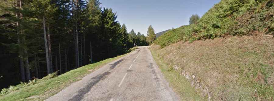
The road through the pass is fully paved. It's called the D618 road (the former Route Nationale 618, the "Route of the Pyrenees"). The drive is pretty challenging, as it features steep parts, many curves, and a few hairpin turns.
What was the Route of the Pyrenees?
The road through the pass holds a much grander history; it was once part of the legendary Route Nationale 618 (RN 618), an ambitious, 450-kilometer French national road famously dubbed the "Route of the Pyrénées" because it traversed numerous high-altitude passes that are now iconic in the Tour de France. This pivotal artery served as a major thoroughfare that provided a scenic link between the Atlantic Ocean at Saint-Jean-de-Luz and the Mediterranean Sea at Argelès-sur-Mer. Although the entire route was down-graded in 1970 and subsequently split into departmental roads (the D918 and the D618), the path still carries the heritage of one of France's most important and challenging mountain routes.
How long is the road through Col de Port?
Set high in the Massif de l'Arize of the French Pyrenees, the pass is 29km (18 miles) long, running west-east from Massat to Tarascon-sur-Ariège.
Is Col de Port steep?
The pass has been featured several times in the Tour de France and is popular with touring cyclists. Starting from Massat, the ascent is 12.8 km long. Over this distance, the elevation gain is 601 meters. The average percentage is 4.7%. And starting from the D8 - D618 road, the ascent is 17 km long. Over this distance, the elevation gain is 777 meters. The average percentage is 4.6%.