How difficult is the military road to Pierre-sur-Haute in France?
Pierre-sur-Haute is the highest point of the Monts du Forez, reaching an elevation of 1,631m (5,351ft) above sea level in the Massif Central. Straddling the border between the Loire and Puy-de-Dôme departments, the summit is a fortress of antennas and military gear. The road to the top is a strange, hybrid beast: a narrow strip of asphalt on one side and a broken dirt track on the other, where the weather is so violent that the French Air Force often has to abandon wheels for tracked vehicles to reach the base.
| Road facts: Pierre-sur-Haute | |
|---|---|
| Location | Massif Central, France (Loire / Puy-de-Dôme) |
| Elevation | 1,631 m (5,351 ft) |
| Length | 14.3 km (8.8 miles) |
| Surface | Paved (North) / Rough Dirt (South) |
| Access | Strictly Restricted / Military Zone |
How long is the road to Pierre-sur-Haute from Col du Béal?
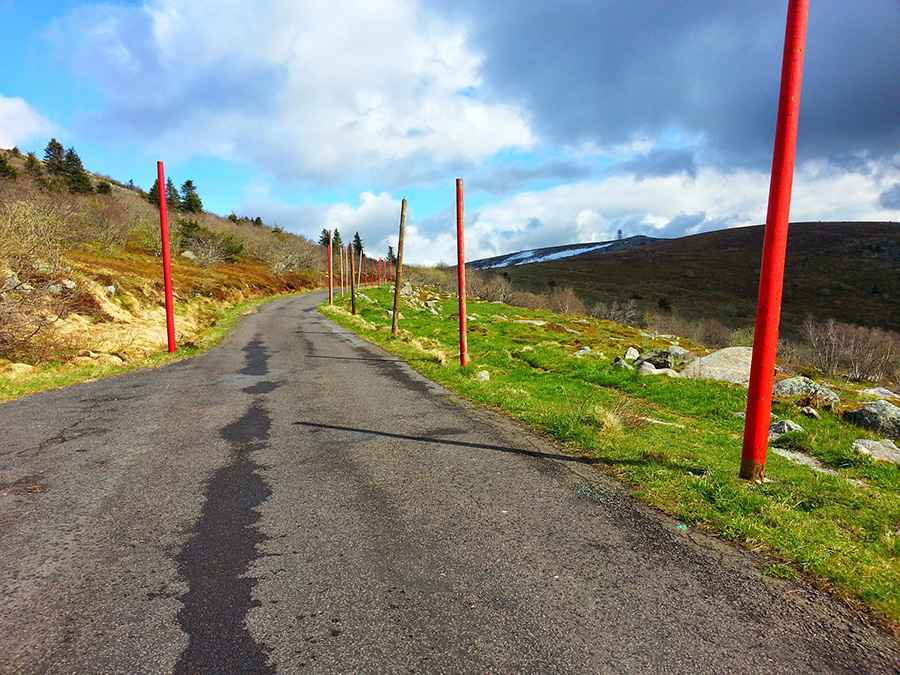
The journey starts at the Col du Béal on the D40 and covers 14.3 km (8.8 miles) across the high ridges. The northern ascent was paved back in 1961 to allow heavy supply trucks to reach the military radio station, but don't expect a standard highway. It is an incredibly narrow ribbon of asphalt, barely wide enough for a single vehicle, with no painted lines and zero safety barriers. On one side, you have the open moorland; on the other, a drop that becomes terrifying when the thick fog of the Massif Central rolls in. The final stretch is strictly off-limits to private cars, guarded by military signs and a high security fence.
Why is the southern track of Pierre-sur-Haute a 4x4 challenge?
While the northern side has asphalt, the southern descent toward Le Perrier is a completely different world. It is a rough, unpaved track that is often shredded by heavy snow and rain. This side of the mountain is exposed to the full force of the Atlantic winds, which can easily reach 150 km/h at the summit. The road here is more of a service trail through the forest and across rocky plateaus where the mud becomes a greasy trap in the autumn. Even for authorized military 4x4s, this southern route is a technical challenge where ground clearance and tire grip are the only things keeping you from sliding off the ridge.
Is the weather dangerous on the road to Pierre-sur-Haute?
The biggest threat on the road to Pierre-sur-Haute isn't the steepness, but the sudden icing and the "burle"—the local name for the freezing winter wind. At 1,631 meters, the weather can flip from sunshine to a blinding blizzard in under ten minutes. The asphalt from Col du Béal becomes a sheet of black ice that is nearly impossible to see, turning the narrow lane into a death trap. For the military personnel stationed at the top, winter driving often means using specialized snowplows or tracked vehicles because the drifts can completely bury the road, making even the most heavy-duty 4x4s useless against the Massif Central’s snowpack.
What are the hazards for drivers near Pierre-sur-Haute?
Even if you can't reach the very summit, driving up to the military gates is a unique experience. However, you have to be alert for hikers who use the asphalt to cross the ridges; on such a narrow road, there simply isn't enough room for a car and a pedestrian to share the space safely. You’ll need to manage your speed carefully, as the lack of guardrails means any mistake or sudden gust of wind can push you off the track. Make sure your brakes are solid for the descent back to the D40, as the constant gradient will cook your pads if you don't use gear braking to hold the car back on the steep, unprotected hairpins.
Pic: Gilles G.