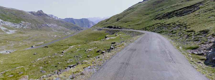
An iconic road to Port de Boucharo in the Pyrenees
Port de Boucharo-Puerto de Bujaruelo is an international high mountain pass at an elevation of 2,278 m (7,473 ft) above sea level, located on the Spanish-French border. The last part of the road to the summit is blocked to vehicles by large rocks.

Where is Port de Boucharo-Puerto de Bujaruelo?
The pass, also known as Port de Gavarnie, is located on the border between the province of Huesca, in the autonomous community of Aragon, in the northern part of Spain, and the Hautes-Pyrénées department in the Occitania region of southwestern France. Apart from the Aragnouet-Bielsa tunnel, it is the lowest point to cross the Franco-Spanish border in the Hautes-Pyrénées.
When was the road through Port de Boucharo-Puerto de Bujaruelo built?
The pass has long been a crossing point of the Pyrenees mountain range. The idea of building a road there dates back many years. Construction of the road was planned by Napoleon I as early as 1811, but it was not until the 1930s that studies were undertaken. With the Spanish Civil War and then World War II, the project was put on hold. Although the road was completed on the French side in 1969, no road was ever built on the Spanish side. Eventually, the last two kilometers between the Col de Tentes and the port of Boucharo were declassified.
Can I drive to Port de Boucharo-Puerto de Bujaruelo?
There are two routes to reach the summit.
On the French side, the road to the summit is fully paved and is called D-923. It’s narrow and steep, with a few hairpin turns. Starting from the town of Gavarnie, the ascent is 12.4 km (7.70 miles) long, with an elevation gain of 895 meters. The average gradient is 7.21%. The last 1.6 km of the road, beyond the parking lot for Col des Tentes, are blocked to vehicles by large rocks (only bikes and pedestrians are allowed). There is a high risk of rockslides.
On the Spanish side, the pass is accessed via a mule track starting from Sant Nicolau de Buixaruelo.
Is the road to Port de Boucharo-Puerto de Bujaruelo open in winter?
Set high in the Pyrenees mountain range, accessibility is largely limited to the summer season (between May and November). Adverse weather conditions are common.