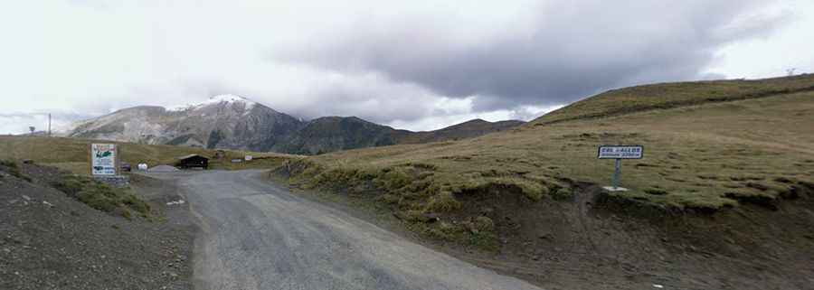
A paved road among the clouds to Col d'Allos in the Provence
Col d'Allos is a high mountain pass at an elevation of 2,250m (7,382ft) above sea level, located in the department of Alpes-de-Haute-Provence in France.
Where is Col d'Allos?
The pass is located in the Provence-Alpes-Côte d'Azur region, in the southeastern part of the country, to the west of the Parc National du Mercantour.
When was the road to Col d'Allos built?
Like many passes in this area, its existence is owed to military strategies aimed at defending against Italian and German attacks. Allos opened in 1891, 22 years before another option to cross this ridge via the Col de la Cayolle was added.
Can you drive through Col d'Allos?
The road to the summit is totally paved in very bad conditions and very challenging with numerous hairpins. It’s called D908. It runs parallel to the Col de la Cayolle and Col de la Bonette.
How is the road to Col d'Allos?
The road surface is quite bumpy, and it's narrow and intimidating. Drivers of caravans and trucks need to be very careful. Not for the faint hearted driver as there are some serious drop-offs. The pass is very steep, hitting a 9% of maximum gradient. It’s one of the most popular climbs in the Tour de France.
How long is Col d'Allos?
The pass is 39.1 km (24.29 miles) long, running south-north from Colmars (or Colmars-les-Alpes) to Barcelonnette.
Is Col d'Allos worth it?
The summit hosts a parking lot and a mountain refuge known as Refuge du Col d'Allos. Along the way, you may come across marmots, sheep or cows grazing in the fields.
Is Col d'Allos open?
Set high in the Southern Alps, the winding road through the pass is closed from October to July. In July and August it is reserved for bicycles on Friday mornings. To the south of the pass, a minor gravel road climbs up Le Signal, a mountain peak at 2.350m (7,709ft) above sea level.