Colle del Lago dei Signori: everything you need to know about this famed road
Colle del Lago dei Signori-Col de Seigneurs is an international high mountain pass at an elevation of 2,130m (6,988ft) above sea level, located on the border of Italy and France.
Where is Colle del Lago dei Signori-Col de Seigneurs?
Set high at the eastern end of the Alpes-Maritimes, the pass links the province of Cuneo, in the southwest of the northwestern Italian region of Piedmont, and the Alpes-Maritimes department, in the Provence-Alpes-Côte d'Azur region of southeastern France.
When was the road through Colle del Lago dei Signori-Col de Seigneurs built?
It's a Ligurian track built in the Middle Ages to transport salt from Ventimiglia to Limone Piemonte and from there to Turin. The road has been enlarged, and many sections were magnified and transformed into military roads to connect the numerous forts located along the border between Italy and France. The road traversing the pass was originally built for military purposes and was used during World War II.
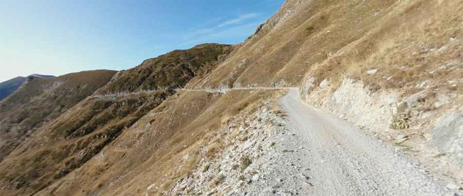
Is the road to Colle del Lago dei Signori-Col de Seigneurs unpaved?
The road to the summit is totally unpaved and somewhat rough around the pass. It’s called Via del Sale. It is a wonderful dirt road that runs along the ridges of the Maritime Alps on the border between Italy and France, offering a wild landscape and stunning views of the sea and the mountains.
Is the road to Colle del Lago dei Signori-Col de Seigneurs open in winters?
The summit hosts a parking lot (Parcheggio Colle del Lago dei Signori) and a mountain hut known as Rifugio Don Barbera. The road to the Col de Seigneurs is officially closed from November 1 to March 31 every year.
Pic: Matteo Quaglia