Discovering the narrow steep road to Col du Sabot in France
Col du Sabot is a high mountain pass at an elevation of 2.100m (6,889ft) above sea level, located in the Isère département in the Rhône-Alpes region of France.
Where is Col du Sabot?
The pass is located in the Oisans area in the southeastern part of the country. The ascent starts a few kilometers past Alpe d’Huez and goes through the alpine pastures of Vaujany.
How long is the road to Col du Sabot?
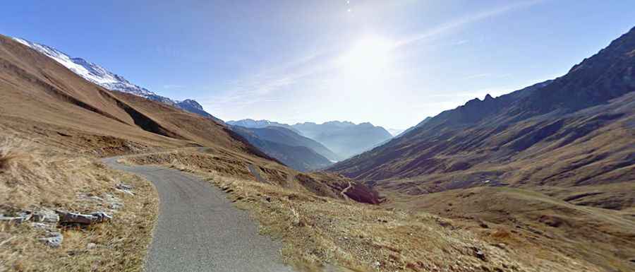
Set high in the Central French Alps, the climb starts from Vaujany, a ski station, and is 10.2 km (6.33 miles) long. The road is very steep in parts and hits a 15.6% of maximum gradient through some of the ramps. The road ends at a small parking lot, and a short walk (about 100 meters) offers a view of the Croix de Fer reservoir.
Is the road to Col du Sabot challenging?
The road to Col du Sabot is challenging. It's a narrow, single-lane tarmac road with worn asphalt, 17 hairpin turns, and steep drop-offs. Drivers need to be cautious, especially during the descent, due to the moderate asphalt condition and occasional gravel and stones. While traffic is generally light, the views at the summit are worth the effort.