Col de Portet: The Ultimate Road Trip Guide
Col de Portet is a high mountain pass at an elevation of 2.215m (7,267ft) above sea level, located in the Hautes-Pyrénées department, in France.
Where is Col de Portet?
The pass is located to the west of Saint-Lary-Soulan, in the Occitanie region, in the southern part of the country, near the Spanish border.
Is the road to Col de Portet paved?
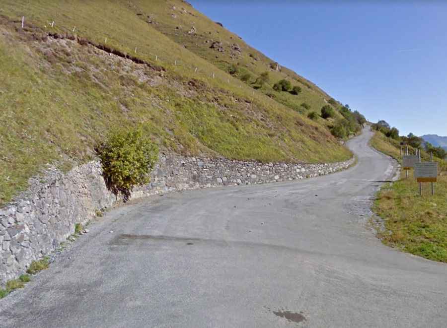
The narrow, twisting and poorly surfaced road to the summit was fully paved in 2018. This aerial road, cut directly into the steep mountain slope, begins offering breathtaking vistas almost immediately and never lets up. The road is pretty challenging and one of the toughest climbs in the Pyrenees, with 14 hairpin turns, very narrow parts and several very steep stretches, making this short climb quite difficult. It’s a big climb heading towards bigger mountains.
Is Col de Portet open?
Set high in the Pyrenees mountain range, during the winter season, the road to the summit remains completely closed, while it is accessible from June to October. However, access to the Pla d'Adet turnoff remains available throughout the year. With minimal traffic, the road is typically closed to motorized vehicles, except for local residents, between 8 a.m. and 3 p.m. during the summer months.
How long is the road to Col de Portet?
The road to the summit is very steep, hitting a 16.3% of maximum gradient through some of the ramps. The ascent is 8.0 km (4.97 miles) long. Over this distance the elevation gain is 655 meters. The average gradient is 8.18%. It’s one of those rare climbs that you can see almost the entire route from down below – it’s hard not to be impressed at the view of the first stretch. With its altitude of 2.215m above sea level, it is higher than the legendary Col du Tourmalet.
Is Col de Portet worth it?
The climb has been featured in the Tour de France race. At the summit, the views are spectacular. Portet's top gives you a spectacular 360-degree view of all the surrounding mountain peaks, too. The constant difficulty of this mountain pass may be enough to make you stop after this climb.