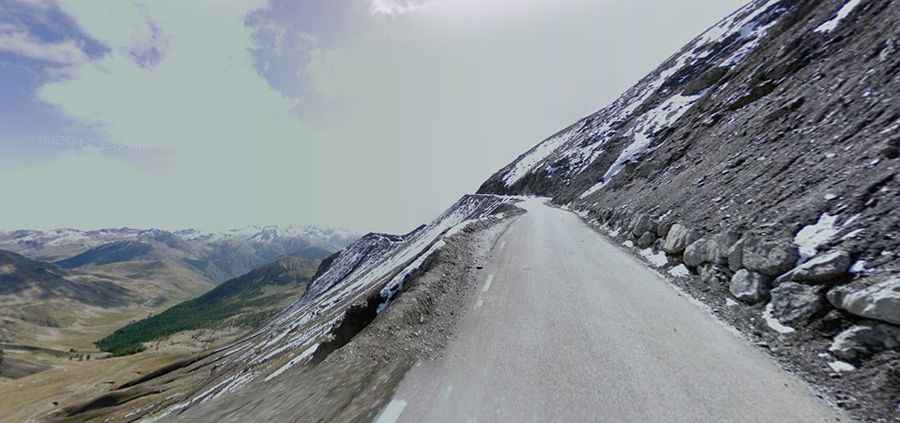
The iconic road to Col de la Bonette in the French Alps
Col de la Bonette is a high mountain pass at an elevation of 2,715m (8,907ft) above sea level, located in the Provence-Alpes-Côte d'Azur region of France.
Where is Col de la Bonette?
The pass is located on the boundary between Alpes-Maritimes and Alpes-de-Haute-Provence departments, within the Mercantour National Park, near the border with Italy. The pass, also known as Col de la Bonette Restefond, links the Ubaye Valley and the Tinée Valley.
Is the road to Col de la Bonette paved?
The road to the summit is totally paved. It’s called D64, part of the scenic Route des Grandes Alpes.
Is Col de la Bonette the highest road in Europe?
Located in southeast France, not far from Nice and next to Cime de la Bonette (at 2,806 masl), a signpost at the foot of the climb claims "Col de la Bonette, the highest road in Europe." But this claim is incorrect for various reasons. Check here for the list of Europe’s highest roads.
Is the road to Col de la Bonette challenging?
The road is generally wide and in very good condition. The road is very steep, and the ascent offers many sensations. It’s a real delight. It lies parallel to the Col d'Allos and Col de la Cayolle.
When was the road to Col de la Bonette built?
The pass was originally a mule track, and the first road through the pass was built in 1832. The final road was completed in 1960.
Is Col de la Bonette open?
Set high in the French Alps, the road is usually closed from late October through late June or early July (depending on snow). It's one of the highest roads in the country.
Is the road to Col de la Bonette steep?
The pass has been featured in the Tour de France. From Jausiers, the ascent is 24 km long, gaining 1,589 meters and with an average percentage of 6.6%. The maximum gradient is 11%. And from Saint Etienne de Tinée, the ascent is 25.8 km long. The elevation gain is 1,652 meters, and the average percentage is 6.4%, hitting a 15% maximum gradient through some of the ramps. Cycling markers are placed at every kilometer on both sides of the mountain road, indicating height, the distance from the start, and the distance to the summit.