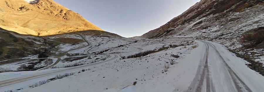
The narrow, bad and old road to the top of Col de Sarenne
Col de Sarenne is a high mountain pass at an elevation of 2.004m (6,574ft) above sea level, located in the Isère department of France. It’s one of the most demanding roads in the country.
Where is Col de Sarenne?
The pass is located in the Rhône-Alpes region, in the southeastern part of the country, high in the Grandes Rousses massif of the Central French Alps. There is a tiny parking lot and restaurant atop the mountain.
Can you drive to Col de Sarenne?
The road to the summit is mostly paved, with a few unpaved sections. It’s called Route du Col de Sarenne. The quality of the road is extremely poor, especially along the sides. The road is not for the faint-hearted, with steep drops and a few sections of unpaved road to challenge even the most experienced driver. Unprotected by guardrails, a mistake could result in a 30-meter fall. It is a beautiful road that, although close to civilization, feels quite remote, partly due to its rough sections and partly because it can be very quiet. It’s very narrow in parts, totally impassable for two average vehicles at the same time. It's closed to bigger vehicles.
How long is Col de Sarenne?
Above the famous Alpe d'Huez there are 2 climbs that can be ridden. One is Col du Poutran. The other is the Col de Sarenne. The pass is 20.9 km (12.98 miles) long, running from Mizoën to Huez. The road is pretty steep, hitting a 14.1% of maximum gradient through some of the ramps. It has been climbed by the Tour de France race.
Is Col de Sarenne open?
The road is closed from the end of October to early June and runs parallel to GR54 (French long-distance trail) for most of the way.