How challenging is the D17 Road in Provence?
D17 is a mountain road located in the Alpes-de-Haute-Provence department, in France. It’s one of the most spectacular balcony roads in France.
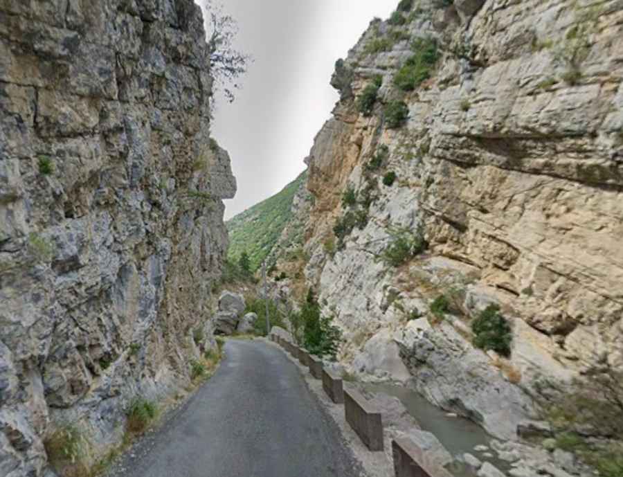
| Road facts: D17 Road | |
|---|---|
| Location | Alpes-de-Haute-Provence, Provence-Alpes-Côte d'Azur (France) |
| Length | 44 km (27.3 miles) |
| Elevation at Summit | Col des Abbès - 1,295 m (4,248 ft) |
| Surface | Paved at both ends, unpaved gravel/dirt middle section |
| Vehicle Restrictions | 3.5t weight limit (Caravans and motorhomes banned) |
| Key Hazards | Sheer drops without guardrails, rockfalls, winter ice, single-lane passages |
Where is the D17 Road?
The road is located in the Provence-Alpes-Côte d'Azur region, in the southeastern part of the country.
Is the D17 Road paved?
The road comprises paved and unpaved sections. It’s paved at both the start and the end, and unpaved in the middle section.
How challenging is the D17 Road?
The single-lane road is pretty narrow and comprises many curves as well as a succession of tight hairpin turns (lacets) carved into raw rock. It hugs the mountainside with no center line. It lacks modern guardrails along sections with sheer drops into the creek below.
How long is the D17 Road?
The road is 44km long, running north-south from Mézel to La Palud-sur-Verdon, near Clue de Carajuan.
Can I drive my vehicle on the D17 Road?
The road has a 3.5t limit and caravans and motorhomes are banned.
Is the D17 Road open year-round?
The road tops out at Col des Abbès, a mountain pass at an elevation of 1295m (4,248ft) above sea level. During winters, the road might be impassable due to ice. It features a high risk of rock slides.