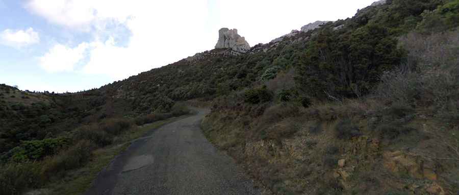
Driving the steep road to Château de Quéribus in Aude
Château de Quéribus is a high-mountain fortress at an elevation of 614 meters (2,014 ft) above sea level, located in the Aude department of France.
| Road facts: Château de Quéribus | |
|---|---|
| Location | Cucugnan, Aude, Occitanie (France) |
| Elevation (Parking) | 614 m (2,014 ft) |
| Length | 3.3 km (2.05 miles) from Cucugnan |
| Elevation Gain | 316 m |
| Average Gradient | 9.57% |
| Max Gradient | 16.4% |
| Surface | Paved / Corrugated asphalt |
Where is Chateau de Queribus?
The fortress is located in the commune of Cucugnan, within of the Occitanie region. Built during the 13th century as a military defensive stronghold on a vertical limestone cliff, the fortress dominates the plain stretching from Tautavel to Caudiès. The structure underwent a complete restoration between 1998 and 2002 to stabilize the crumbling perimeter walls above the road cliffs.
Is the road to Chateau de Queribus paved?
The road to the fortress ends on a parking lot. It’s totally paved, steep and narrow. The surface is old, bumpy, and degraded by winter frosts.
How long is the road to Chateau de Queribus?
Starting from the D123 junction near Cucugnan, the road to the summit is 3.3 km long. Over this distance, the elevation gain is 316 m and the average gradient is 9.57%. The road sharpens significantly during the final two kilometers, where the gradient spikes to a maximum of 16.4%.
Where does the road to Château de Quéribus end?
Vehicular access ends at a dead-end parking lot located at 614 meters above sea level, directly beneath the fortress. The final 300 meters to the castle must be covered on foot via a steep, unpaved gravel trail that becomes highly slippery during rain or high-humidity fog conditions.