How to drive is the D54 road to Col du Sappenay in France?
Col du Sappenay is a mountain pass at an elevation of 897 meters (2,942 ft) above sea level located in the Savoie department of France.
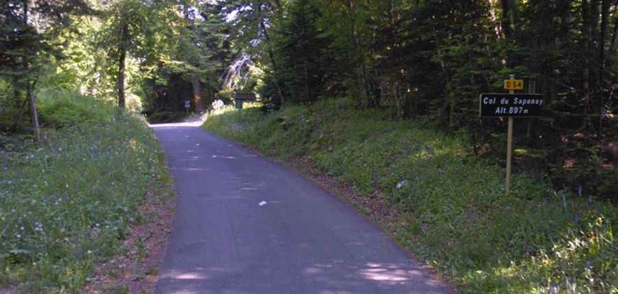
| Road facts: Col du Sappenay | |
|---|---|
| Location | Savoie, Auvergne-Rhône-Alpes (France) |
| Elevation | 897 m (2,942 ft) |
| Length | 7.5 km (4.6 miles) from Chindrieux |
| Average Gradient | 7.38% |
| Layout | 11 hairpin turns |
| Surface | Fully paved asphalt |
Where is Col du Sappenay?
The pass, also spelled as Col du Sapenay, is located in the Auvergne-Rhône-Alpes region, in the south-eastern part of the country.
Is the road to Col du Sappenay paved?
The road through the pass is totally paved. It’s called D54 (Route du Sappenay). The road features 11 sharp hairpin turns concentrated in the middle sector. It has narrow parts with steep drop-offs. Drivers must also look out for slow agricultural tractors on blind bends and vehicles from paragliders turning around near the summit launch clearings.
How long and steep is the road to Col du Sappenay?
Starting near the shores of Lake Bourget in the village of Chindrieux, the road to the summit is 7.5 kilometers (4.6 miles) long. Over this distance, the elevation gain is 554 m and the average gradient is 7.38%.
Is the road to Col du Sappenay dangerous in winters?
Set high in the Jura Mountains, winter weather causes regular ice and snow accumulations. Because the D54 is classified as a secondary route, regional snowplow priority is low, leading to delayed clearance after heavy storms. Temperatures frequently drop below freezing, turning the humid forest sections into black ice.